Approximate Location Map
Large Map »
Latitude: 51.8083 / 51°48'29"N
Longitude: -1.6388 / 1°38'19"W
OS Eastings: 424996
OS Northings: 212242
OS Grid: SP249122
Mapcode National: GBR 5SW.LHD
Mapcode Global: VHBZS.JTZ5
Plus Code: 9C3WR956+8F
Entry Name: Brewery and Malthouse to Rear
Listing Date: 12 September 1955
Grade: II
Source: Historic England
Source ID: 1225265
English Heritage Legacy ID: 421557
ID on this website: 101225265
Location: Burford, West Oxfordshire, OX18
County: Oxfordshire
District: West Oxfordshire
Civil Parish: Burford
Built-Up Area: Burford
Traditional County: Oxfordshire
Lieutenancy Area (Ceremonial County): Oxfordshire
Church of England Parish: Burford
Church of England Diocese: Oxford
Tagged with: Brewery
BURFORD AND UPTON SHEEP STREET
AND SIGNET (North side)
SP2412-2512 Brewery and Malthouse
5/194; 7/194 to rear
12.9.55
GV II
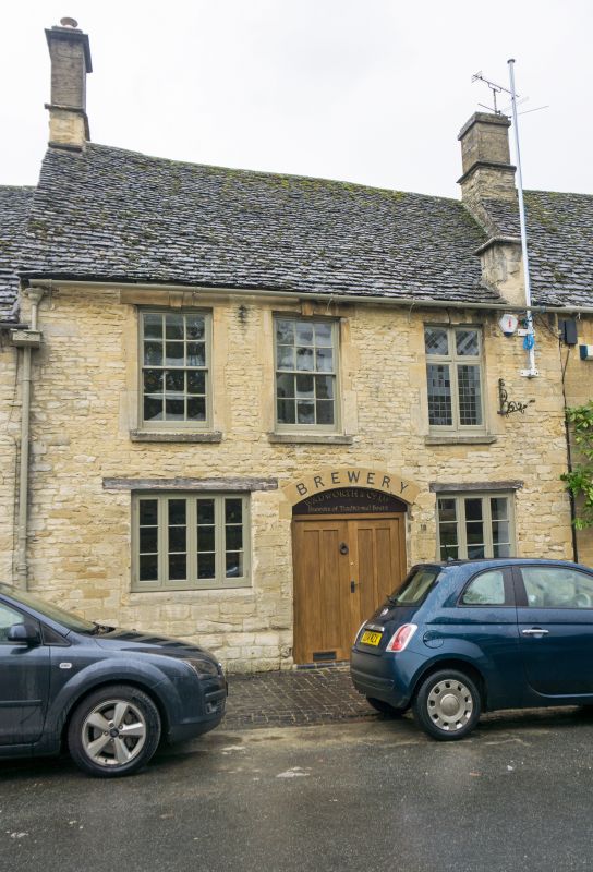
House with brewery to rear. Probably C18. Coursed rubble with Cotswold
stone roof. Ashlar end chimney to left, corner wall-face chimney to
right. 2 storeys; 3 windows on 1st floor, glazing-bar sashes, segmental
central archway of c.1830 and flanking timber lintel. 3-light casements,
the left-hand one re-using a mullion-window cill. Plank door of c.1946
Courtyard plan, brewery ranges lead to early C18 malthouse. The Malthouse
has chamfered mullion windows in rebated surrounds, single lights to long
wing; segmental entry at south end. Apparent tie-beam ends. Hipped-roof
east wing with 3-light mullion window and louvred cupola. Corner block to
Priory Lane of mid C19. 2 storeys, irregular with loft doors off centre,
wing with 3 windows and central doors to left, and wing with wide-spaced
windows to right, segmental head windows on ground floor. An important
element in Priory Lane.
Listing NGR: SP2499612242
External links are from the relevant listing authority and, where applicable, Wikidata. Wikidata IDs may be related buildings as well as this specific building. If you want to add or update a link, you will need to do so by editing the Wikidata entry.


Other nearby listed buildings
