Latitude: 51.2681 / 51°16'5"N
Longitude: 0.5082 / 0°30'29"E
OS Eastings: 575071
OS Northings: 155096
OS Grid: TQ750550
Mapcode National: GBR PR6.H90
Mapcode Global: VHJMD.RDJ6
Plus Code: 9F327G95+77
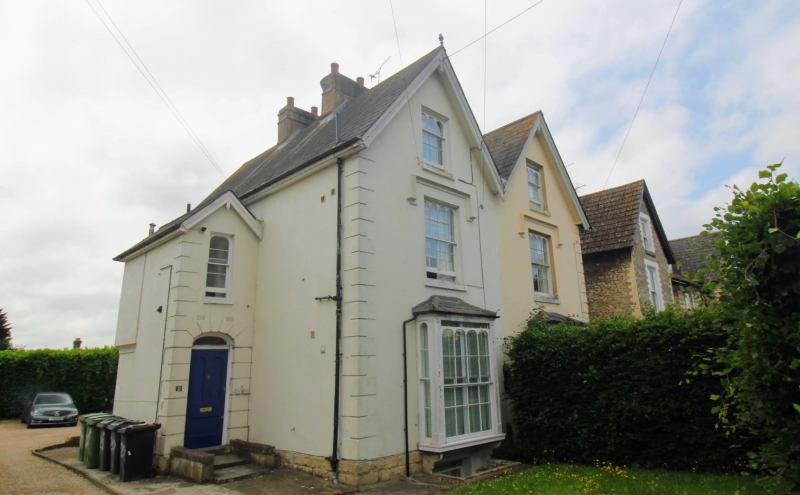
Entry Name: 20 and 22, Upper Fant Road
Listing Date: 2 August 1974
Grade: II
Source: Historic England
Source ID: 1225505
English Heritage Legacy ID: 421903
ID on this website: 101225505
Location: Lower Fant, Maidstone, Kent, ME16
County: Kent
District: Maidstone
Electoral Ward/Division: Fant
Parish: Non Civil Parish
Built-Up Area: Maidstone
Traditional County: Kent
Lieutenancy Area (Ceremonial County): Kent
Tagged with: Building
UPPER FANT ROAD 1. 5278 (South Side) Nos 20 and 22 TQ 75 NeE 9/367 II
2. A pair circa 186O. 2 storeys attics and basement stuccoed. 2 gables with carved bargeboards, pendants and finials. Long and short quoins. 4 windows in all. The centre 2 windows are in a projecting portion. Sashes with glazing bars intact and Gothic heads with hood moulding over to lower floors. 3-light bays to ground floor. Cambered doorcases with stone voussoirs.
Listing NGR: TQ7506855092
External links are from the relevant listing authority and, where applicable, Wikidata. Wikidata IDs may be related buildings as well as this specific building. If you want to add or update a link, you will need to do so by editing the Wikidata entry.


Other nearby listed buildings