Approximate Location Map
Large Map »
Latitude: 53.6307 / 53°37'50"N
Longitude: -1.7475 / 1°44'51"W
OS Eastings: 416794
OS Northings: 414933
OS Grid: SE167149
Mapcode National: GBR JV7G.G7
Mapcode Global: WHCB8.403H
Plus Code: 9C5WJ7J2+7X
Entry Name: 65, Westgate
Listing Date: 2 June 1976
Grade: II
Source: Historic England
Source ID: 1225545
English Heritage Legacy ID: 421023
ID on this website: 101225545
Location: Almondbury, Kirklees, West Yorkshire, HD5
County: Kirklees
Electoral Ward/Division: Almondbury
Parish: Non Civil Parish
Built-Up Area: Huddersfield
Traditional County: Yorkshire
Lieutenancy Area (Ceremonial County): West Yorkshire
Church of England Parish: Almondbury with Farnley Tyas Team Parish
Church of England Diocese: Leeds
Tagged with: Building
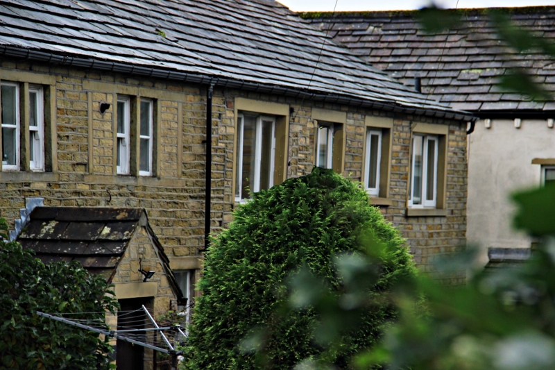
WESTGATE
1.
5113
(South Side)
Almondbury
No 65
SE 1614 45/74 2.6.76.
II GV
2.
C18 or early C19. Coursed rubble. Pitched stone slate roof. 2 storeys.
One 2-light stone mullioned sash and 4-light stone mullioned sash (2 lights
blocked) on 1st floor. One 2-light stone mullioned sash and one fixed window
on ground floor. One door with 4 moulded panels.
Listing NGR: SE1678914942
External links are from the relevant listing authority and, where applicable, Wikidata. Wikidata IDs may be related buildings as well as this specific building. If you want to add or update a link, you will need to do so by editing the Wikidata entry.


Other nearby listed buildings
