Approximate Location Map
Large Map »
Latitude: 53.6308 / 53°37'51"N
Longitude: -1.7488 / 1°44'55"W
OS Eastings: 416711
OS Northings: 414952
OS Grid: SE167149
Mapcode National: GBR JV7G.65
Mapcode Global: WHCB2.3ZJX
Plus Code: 9C5WJ7J2+8F
Entry Name: 32 and 34, Westgate
Listing Date: 29 September 1978
Grade: II
Source: Historic England
Source ID: 1224853
English Heritage Legacy ID: 421014
ID on this website: 101224853
Location: Almondbury, Kirklees, West Yorkshire, HD5
County: Kirklees
Electoral Ward/Division: Almondbury
Parish: Non Civil Parish
Built-Up Area: Huddersfield
Traditional County: Yorkshire
Lieutenancy Area (Ceremonial County): West Yorkshire
Church of England Parish: Almondbury with Farnley Tyas Team Parish
Church of England Diocese: Leeds
Tagged with: Building
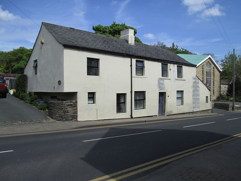
WESTGATE
1.
5113
(North Side)
Almondbury
Nos 32 and 34
SE 1614 45/1377
II
2.
Apparently C19, but possibly older. Coursed rubble. Pitched stone slate roof.
Red brick stacks. 2 storeys. 3 ranges of sashes. 2 doors with 4 moulded
panels each.
Listing NGR: SE1671114952
External links are from the relevant listing authority and, where applicable, Wikidata. Wikidata IDs may be related buildings as well as this specific building. If you want to add or update a link, you will need to do so by editing the Wikidata entry.


Other nearby listed buildings
