Approximate Location Map
Large Map »
Latitude: 51.4942 / 51°29'39"N
Longitude: -0.1638 / 0°9'49"W
OS Eastings: 527568
OS Northings: 178848
OS Grid: TQ275788
Mapcode National: GBR 7L.DK
Mapcode Global: VHGQZ.3PSX
Plus Code: 9C3XFRVP+MF
Entry Name: 10, Milner Street SW3
Listing Date: 15 April 1969
Last Amended: 7 November 1984
Grade: II
Source: Historic England
Source ID: 1225645
English Heritage Legacy ID: 422088
Also known as: Stanley House
ID on this website: 101225645
Location: Brompton, Kensington and Chelsea, London, SW3
County: London
District: Kensington and Chelsea
Electoral Ward/Division: Brompton & Hans Town
Parish: Non Civil Parish
Built-Up Area: Kensington and Chelsea
Traditional County: Middlesex
Lieutenancy Area (Ceremonial County): Greater London
Church of England Parish: St Simon Upper Chelsea
Church of England Diocese: London
Tagged with: House
TQ 2778 NE MILNER STREET SW3
49/3
15.4.69 No 10
(former listed as No 14)
II
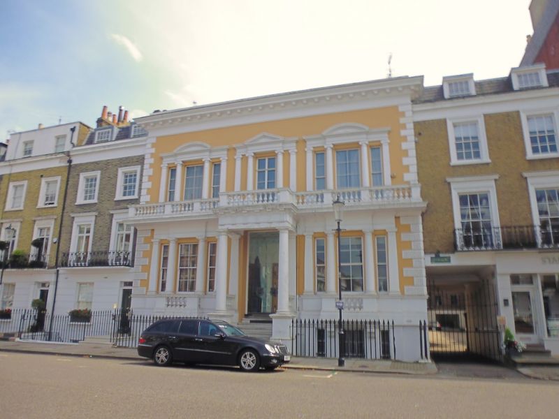
Substantial house. Early-mid C19. Two storeys and basement. Stucco. Three windows.
Ground floor windows with balustered balconies, the windows framed by Doric pilasters
and columns. Cornice over. Central door with Doric columned porch, wide flight of
steps up. Open balustered balcony across first floor. Three part windows divided by
Ionic columns and pilasters. Dentilled cornice, with segmental pediments to outer
windows and triangular to centre. Heavy modillioned cornice to parapet. Angle quoins,
vermiculated to ground floor.
Listing NGR: TQ2756878848
External links are from the relevant listing authority and, where applicable, Wikidata. Wikidata IDs may be related buildings as well as this specific building. If you want to add or update a link, you will need to do so by editing the Wikidata entry.


Other nearby listed buildings
