Latitude: 51.7809 / 51°46'51"N
Longitude: -1.6646 / 1°39'52"W
OS Eastings: 423237
OS Northings: 209191
OS Grid: SP232091
Mapcode National: GBR 5T7.60M
Mapcode Global: VHBZZ.3HCM
Plus Code: 9C3WQ8JP+95
Entry Name: Manor Farmhouse and Attached Outbuilding Range
Listing Date: 12 September 1955
Grade: II
Source: Historic England
Source ID: 1225702
English Heritage Legacy ID: 422185
ID on this website: 101225702
Location: Holwell, West Oxfordshire, OX18
County: Oxfordshire
District: West Oxfordshire
Civil Parish: Holwell
Traditional County: Oxfordshire
Lieutenancy Area (Ceremonial County): Oxfordshire
Church of England Parish: Holwell
Church of England Diocese: Oxford
Tagged with: Farmhouse
HOLWELL SP20NW 3/258 Manor Farmhouse and 12.9.55 attached outbuilding range.
GV II
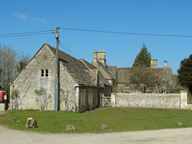
Farmhouse. C17, altered C18. Rubble with Cotswold stone roofs. Irregular plan with extensive wings forming a rough T-shape. 2 storeys and attic; ashlar chimneys, one especially fine group of 4 central to main part, creating lobby entrance. Mullioned windows with drips, of 2 and 3 lights. Main part 2 windows, gable for dormer to right. Further chimney to left-hand and an extensive range of outbuildings beyond of single storey and single storey and attic ending to south with an original- looking mullioned window in gable. 2-storey L-plan wing to right with 2 windows, the return of this wing to east has 2 gables at irregular levels with mullion windows, square plan chimney. Irregular extensions to west. Very picturesque organically developed house.
Listing NGR: SP2323709191
External links are from the relevant listing authority and, where applicable, Wikidata. Wikidata IDs may be related buildings as well as this specific building. If you want to add or update a link, you will need to do so by editing the Wikidata entry.


Other nearby listed buildings