Approximate Location Map
Large Map »
Latitude: 51.135 / 51°8'6"N
Longitude: 0.2608 / 0°15'39"E
OS Eastings: 558273
OS Northings: 139735
OS Grid: TQ582397
Mapcode National: GBR MPS.LT6
Mapcode Global: VHHQD.GQRR
Plus Code: 9F3247P6+28
Entry Name: 20, Mount Ephraim Road
Listing Date: 7 June 1974
Grade: II
Source: Historic England
Source ID: 1225744
English Heritage Legacy ID: 168094
ID on this website: 101225744
Location: Royal Tunbridge Wells, Tunbridge Wells, Kent, TN1
County: Kent
District: Tunbridge Wells
Electoral Ward/Division: Culverden
Parish: Non Civil Parish
Built-Up Area: Royal Tunbridge Wells
Traditional County: Kent
Lieutenancy Area (Ceremonial County): Kent
Church of England Parish: Tunbridge Wells St John
Church of England Diocese: Rochester
Tagged with: Building
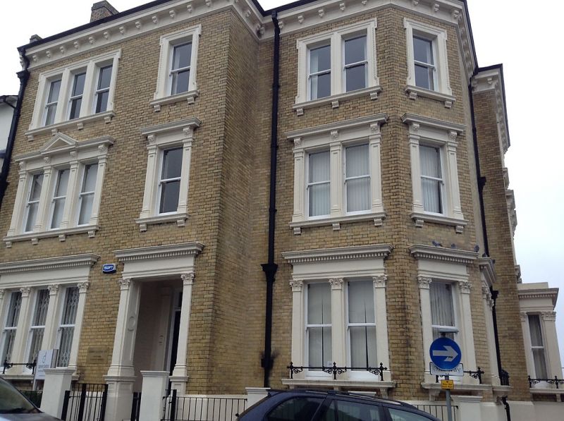
MOUNT EPHRAIM ROAD
1.
1746
(North Side)
No 20
TQ 5839 NW 3/276
II GV
2.
Circa l86O. 3 storeys yellow brick. Slate roof with bracket eaves cornice. 2
sashes. 1 of which is 3-light, set in moulded surrounds. Pediment over left
side 1st floor window. Ground floor window has pilasters. Simple doorcase.
Included for group value.
Nos 18 to 24 (even) form a group.
Listing NGR: TQ5827739736
External links are from the relevant listing authority and, where applicable, Wikidata. Wikidata IDs may be related buildings as well as this specific building. If you want to add or update a link, you will need to do so by editing the Wikidata entry.


Other nearby listed buildings
