Approximate Location Map
Large Map »
Latitude: 54.6516 / 54°39'5"N
Longitude: -2.5786 / 2°34'42"W
OS Eastings: 362765
OS Northings: 528648
OS Grid: NY627286
Mapcode National: GBR BGFN.JB
Mapcode Global: WH92K.CBBW
Plus Code: 9C6VMC2C+JH
Entry Name: Sundial to Southwest of Church of St Edmund
Listing Date: 12 April 1984
Grade: II
Source: Historic England
Source ID: 1226222
English Heritage Legacy ID: 423379
ID on this website: 101226222
Location: St Edmund's Church, Newbiggin, Westmorland and Furness, Cumbria, CA10
County: Cumbria
District: Eden
Town: Eden
Civil Parish: Newbiggin
Built-Up Area: Temple Sowerby
Traditional County: Westmorland
Lieutenancy Area (Ceremonial County): Cumbria
Church of England Parish: Newbiggin St Edmund
Church of England Diocese: Carlisle
Tagged with: Sundial
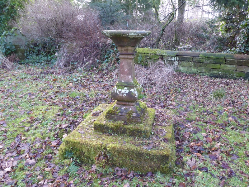
NY 6227 NEWBIGGIN
16/108 Sundial to southwest
of Church of St Edmund
G.V. II
Sundial, probably mid C19. Moulded, square section, baluster on stepped base;
plate survives.
Listing NGR: NY6276528648
External links are from the relevant listing authority and, where applicable, Wikidata. Wikidata IDs may be related buildings as well as this specific building. If you want to add or update a link, you will need to do so by editing the Wikidata entry.


Other nearby listed buildings
