Approximate Location Map
Large Map »
Latitude: 51.4874 / 51°29'14"N
Longitude: -0.1557 / 0°9'20"W
OS Eastings: 528148
OS Northings: 178110
OS Grid: TQ281781
Mapcode National: GBR 9N.6Z
Mapcode Global: VHGQZ.8W13
Plus Code: 9C3XFRPV+XP
Entry Name: Pair of Gatepiers to South East of Main Buildings, Royal Hospital
Listing Date: 15 April 1969
Grade: II
Source: Historic England
Source ID: 1226385
English Heritage Legacy ID: 423630
ID on this website: 101226385
Location: Chelsea, Kensington and Chelsea, London, SW3
County: London
District: Kensington and Chelsea
Electoral Ward/Division: Royal Hospital
Parish: Non Civil Parish
Built-Up Area: Kensington and Chelsea
Traditional County: Middlesex
Lieutenancy Area (Ceremonial County): Greater London
Church of England Parish: St Luke and Christ Church Chelsea
Church of England Diocese: London
Tagged with: Gatepost
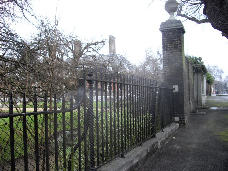
TQ 2878 SW ROYAL HOSPITAL ROAD SW3
58/5
15.4.69 Pair of Gatepiers to
south-east of main buildings,
Royal Hospital
GV
II
Probably c1700. Portland stone piers with foliated cornices.
Listing NGR: TQ2814878110
External links are from the relevant listing authority and, where applicable, Wikidata. Wikidata IDs may be related buildings as well as this specific building. If you want to add or update a link, you will need to do so by editing the Wikidata entry.


Other nearby listed buildings
