Approximate Location Map
Large Map »
Latitude: 51.4858 / 51°29'8"N
Longitude: -0.1555 / 0°9'19"W
OS Eastings: 528169
OS Northings: 177925
OS Grid: TQ281779
Mapcode National: GBR 9P.8K
Mapcode Global: VHGQZ.8X5D
Plus Code: 9C3XFRPV+8R
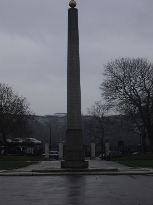
Entry Name: Memorial Obelisk, Royal Hospital
Listing Date: 15 April 1969
Grade: II
Source: Historic England
Source ID: 1226474
English Heritage Legacy ID: 423782
ID on this website: 101226474
Location: Chelsea, Kensington and Chelsea, London, SW3
County: London
District: Kensington and Chelsea
Electoral Ward/Division: Royal Hospital
Parish: Non Civil Parish
Built-Up Area: Kensington and Chelsea
Traditional County: Middlesex
Lieutenancy Area (Ceremonial County): Greater London
Church of England Parish: St Luke and Christ Church Chelsea
Church of England Diocese: London
TQ 2877 NW ROYAL HOSPITAL ROAD SW3
64/1
15.4.69
Memorial obelisk, Royal
Hospital
GV
II
1849 granite obelisk and WI gates with stone piers.
Listing NGR: TQ2816977925
External links are from the relevant listing authority and, where applicable, Wikidata. Wikidata IDs may be related buildings as well as this specific building. If you want to add or update a link, you will need to do so by editing the Wikidata entry.


Other nearby listed buildings
