Approximate Location Map
Large Map »
Latitude: 51.5274 / 51°31'38"N
Longitude: -0.0853 / 0°5'6"W
OS Eastings: 532921
OS Northings: 182676
OS Grid: TQ329826
Mapcode National: GBR S6.ZN
Mapcode Global: VHGQT.GWS0
Plus Code: 9C3XGWG7+WV
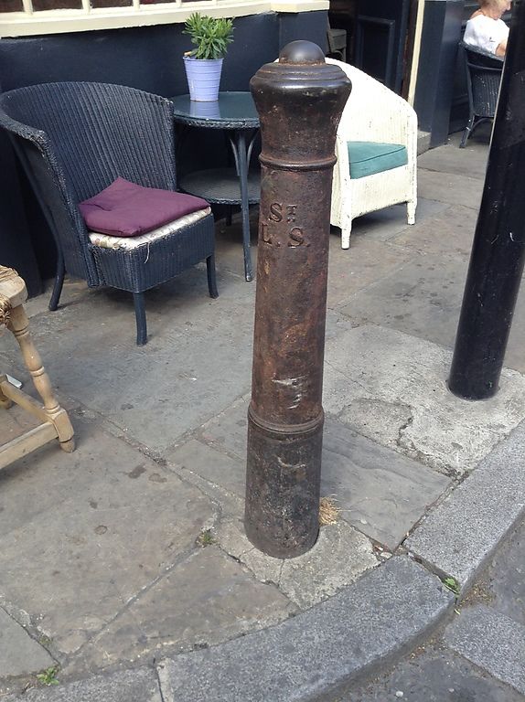
Entry Name: Post on Pavement in Front of Prince Arthur Public House
Listing Date: 4 February 1975
Grade: II
Source: Historic England
Source ID: 1226401
English Heritage Legacy ID: 423657
ID on this website: 101226401
Location: Shoreditch, Hackney, London, N1
County: London
District: Hackney
Electoral Ward/Division: Hoxton West
Parish: Non Civil Parish
Built-Up Area: Hackney
Traditional County: Middlesex
Lieutenancy Area (Ceremonial County): Greater London
Church of England Parish: St John the Baptist with Christchurch, Hoxton
Church of England Diocese: London
Tagged with: Architectural structure
1.
5013
TQ 3282
34/87
BRUNSWICK PLACE N1
(North Side)
Post on pavement in front of Prince Arthur Public House
II
2.
Early-mid C19 cast gunpost, inscribed: "St.L.S."
Listing NGR: TQ3292182676
External links are from the relevant listing authority and, where applicable, Wikidata. Wikidata IDs may be related buildings as well as this specific building. If you want to add or update a link, you will need to do so by editing the Wikidata entry.


Other nearby listed buildings
