Approximate Location Map
Large Map »
Latitude: 53.6146 / 53°36'52"N
Longitude: -1.3473 / 1°20'50"W
OS Eastings: 443279
OS Northings: 413310
OS Grid: SE432133
Mapcode National: GBR MV1N.30
Mapcode Global: WHDCL.8DPV
Plus Code: 9C5WJM73+R3
Entry Name: Milepost at Se 432 133
Listing Date: 11 May 1988
Grade: II
Source: Historic England
Source ID: 1226647
English Heritage Legacy ID: 424035
ID on this website: 101226647
Location: Little Hemsworth, Wakefield, West Yorkshire, WF9
County: Wakefield
Civil Parish: Hemsworth
Built-Up Area: Hemsworth
Traditional County: Yorkshire
Lieutenancy Area (Ceremonial County): West Yorkshire
Church of England Parish: Hemsworth St Helen
Church of England Diocese: Leeds
Tagged with: Milestone
HEMSWORTH STATION ROAD
SE41SW
(east side)
5/56 Milepost at SE432133
-
- II
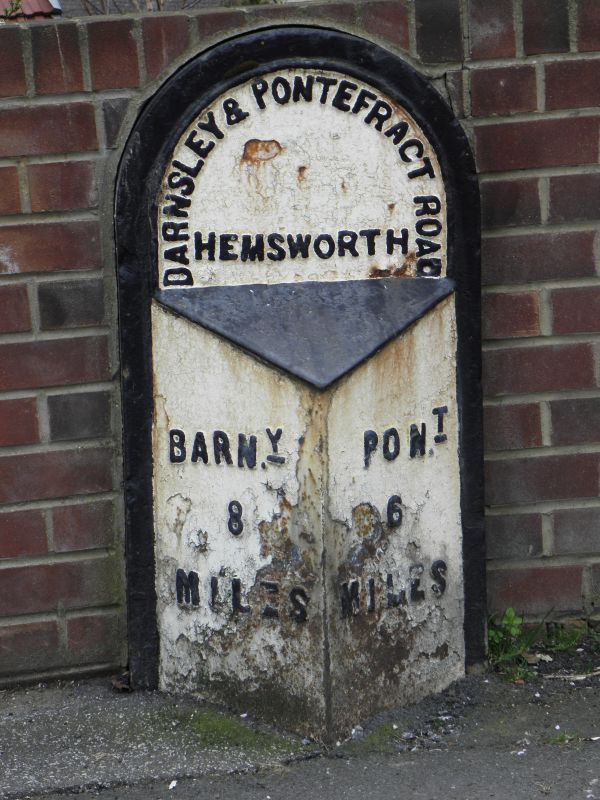
Milepost. Early to mid C19. Sandstone with cast-iron facing plate.
Triangular in section and approx. 1 metre high; flat-faced semicircular head
and chamfered sides with raised lettering:-
"BARNSLEY & PONTEFRACT ROAD" (round the head)
"HEMSWORTH"
"BARNY "PONT
8 6
MILES" MILES"
Listing NGR: SE4327913310
External links are from the relevant listing authority and, where applicable, Wikidata. Wikidata IDs may be related buildings as well as this specific building. If you want to add or update a link, you will need to do so by editing the Wikidata entry.


Other nearby listed buildings
