Approximate Location Map
Large Map »
Latitude: 52.0635 / 52°3'48"N
Longitude: -2.2178 / 2°13'4"W
OS Eastings: 385164
OS Northings: 240587
OS Grid: SO851405
Mapcode National: GBR 1HP.Q3D
Mapcode Global: VH93D.HDWH
Plus Code: 9C4V3Q7J+9V
Entry Name: 2A, New Street
Listing Date: 27 July 1983
Grade: II
Source: Historic England
Source ID: 1226860
English Heritage Legacy ID: 424351
ID on this website: 101226860
Location: Upton upon Severn, Malvern Hills, Worcestershire, WR8
County: Worcestershire
District: Malvern Hills
Civil Parish: Upton-upon-Severn
Built-Up Area: Upton upon Severn
Traditional County: Worcestershire
Lieutenancy Area (Ceremonial County): Worcestershire
Church of England Parish: Upton-on-Severn
Church of England Diocese: Worcester
Tagged with: Building
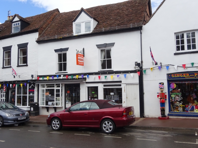
UPTON-UPON-SEVERN NEW STREET
SO 8540
2/41 (north side)
No 2A
GV
II
Circa 1600 timber framed house with modern, rendered, gable ended front. Two-storey.
Plain tile roof. Tie beam-and-collar trusses with angle struts. Two bays. Exposed
timbers in rear wall.
Listing NGR: SO8515540589
External links are from the relevant listing authority and, where applicable, Wikidata. Wikidata IDs may be related buildings as well as this specific building. If you want to add or update a link, you will need to do so by editing the Wikidata entry.


Other nearby listed buildings
