Approximate Location Map
Large Map »
Latitude: 51.5545 / 51°33'16"N
Longitude: -0.0538 / 0°3'13"W
OS Eastings: 535022
OS Northings: 185750
OS Grid: TQ350857
Mapcode National: GBR J6.P46
Mapcode Global: VHGQV.06X5
Plus Code: 9C3XHW3W+QF
Entry Name: 126 and 128, Lower Clapton Road E5
Listing Date: 4 February 1975
Grade: II
Source: Historic England
Source ID: 1226888
English Heritage Legacy ID: 424401
ID on this website: 101226888
Location: Lower Clapton, Hackney, London, E5
County: London
District: Hackney
Electoral Ward/Division: Lea Bridge
Parish: Non Civil Parish
Built-Up Area: Hackney
Traditional County: Middlesex
Lieutenancy Area (Ceremonial County): Greater London
Church of England Parish: St James Clapton
Church of England Diocese: London
Tagged with: Building
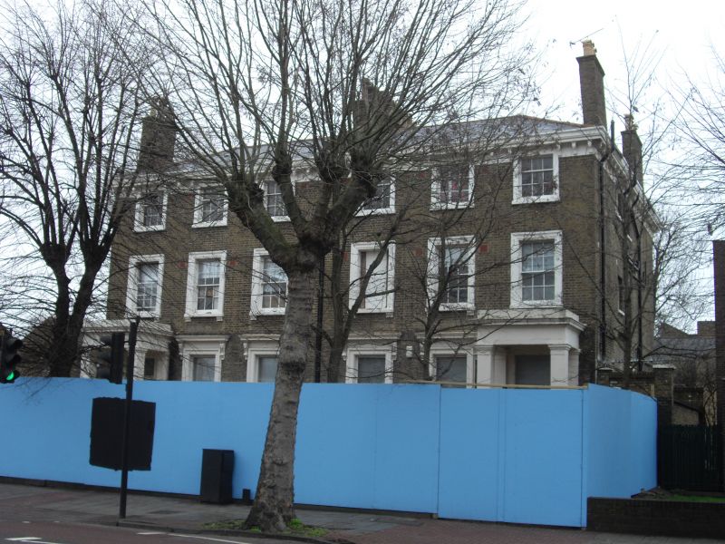
LOWER CLAPTON ROAD E5
1.
5013 (South-East Side)
---------------------
Nos 126 & 128
TQ 3585 20/339
II
2.
Early-mid C19 pair, each 3 storeys and basement, 3 windows. Moderately low pitched
hipped slate roof has eaves cornice and frieze with long brackets. Moulded architraves
to sash windows, those on upper floors with glazing bars; ground floor windows
replaced, and have console bracketed cornices. 4-panel doors with rectangular
fanlights in prostyle porches with square columns.
Listing NGR: TQ3502285750
External links are from the relevant listing authority and, where applicable, Wikidata. Wikidata IDs may be related buildings as well as this specific building. If you want to add or update a link, you will need to do so by editing the Wikidata entry.


Other nearby listed buildings
