Latitude: 53.0091 / 53°0'32"N
Longitude: -1.1269 / 1°7'36"W
OS Eastings: 458679
OS Northings: 346105
OS Grid: SK586461
Mapcode National: GBR LV1.6G
Mapcode Global: WHDGL.NMLK
Plus Code: 9C5W2V5F+J6
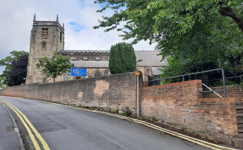
Entry Name: Boundary Wall at Church of St Mary
Listing Date: 27 April 1987
Grade: II
Source: Historic England
Source ID: 1227479
English Heritage Legacy ID: 425285
ID on this website: 101227479
Location: Redhill, Gedling, Nottinghamshire, NG5
County: Nottinghamshire
District: Gedling
Electoral Ward/Division: Redhill
Parish: Non Civil Parish
Built-Up Area: Arnold
Traditional County: Nottinghamshire
Lieutenancy Area (Ceremonial County): Nottinghamshire
Church of England Parish: Arnold
Church of England Diocese: Southwell and Nottingham
Tagged with: Wall
GEDLING CHURCH LANE SK 54 NE Arnold (north east side) 4/47 Boundary wall at Church of St. Mary G.V. II Boundary wall. 1841. Coursed and squared rubble with ramped shaped coping. Datestone to south east inscribed '1841'. Approx. 120M long. Included for group value only.
Listing NGR: SK5867946105
External links are from the relevant listing authority and, where applicable, Wikidata. Wikidata IDs may be related buildings as well as this specific building. If you want to add or update a link, you will need to do so by editing the Wikidata entry.


Other nearby listed buildings