Latitude: 51.5372 / 51°32'13"N
Longitude: -0.1526 / 0°9'9"W
OS Eastings: 528225
OS Northings: 183649
OS Grid: TQ282836
Mapcode National: GBR 93.X4
Mapcode Global: VHGQS.9MPG
Plus Code: 9C3XGRPW+VX
Entry Name: Cumberland Footbridge
Listing Date: 16 May 1978
Grade: II*
Source: Historic England
Source ID: 1227628
English Heritage Legacy ID: 425539
ID on this website: 101227628
Location: Westminster, London, NW1
County: London
District: City of Westminster
Electoral Ward/Division: Regent's Park
Built-Up Area: City of Westminster
Traditional County: Middlesex
Lieutenancy Area (Ceremonial County): Greater London
Church of England Parish: St Mary Magdalene Munster Sq.
Church of England Diocese: London
In the entry for:-
TQ 2883 NW Regents Park NW1
6/1 Cumberland Footbridge
16.5.78
The grade shall be upgraded to II* Star.
------------------------------------
In the entry for:
TQ 2882 NW CITY OF WESTMINSTER REGENT'S PARK, NWl
6/1
16.5.78 Cumberland Footbridge
G.V. II
the Grade shall be amended to read Grade II* (star).
------------------------------------
TQ 2833 SW CITY OF WESTMINSTER REGENT'S PARK NW 1
6/1
Cumberland Footbridge
16.5.78
G.V. II
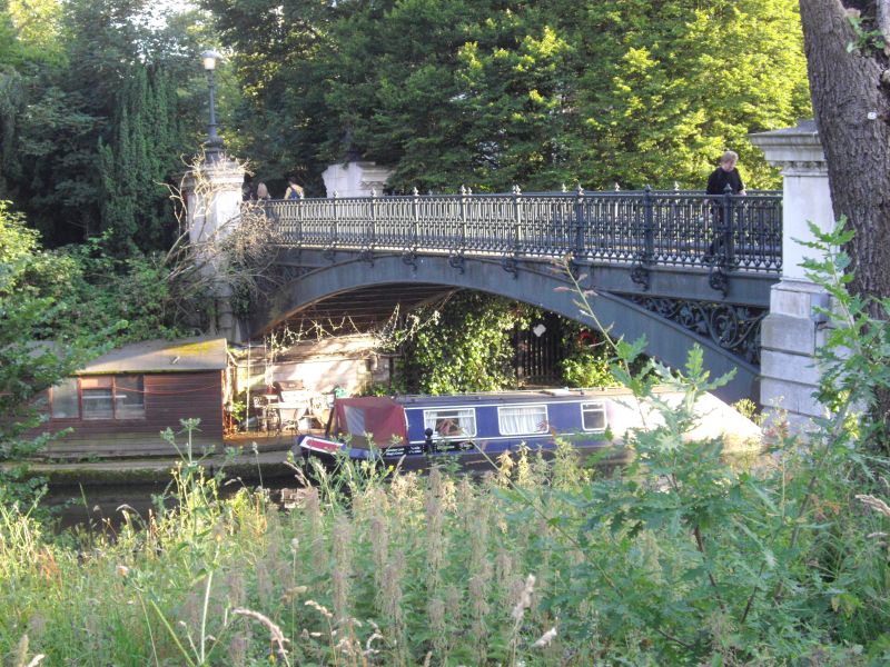
Canal footbridge. Dated 1864, with founder's mark: Henry Grissell of the
Regent's Canal Company's Hoxton Ironworks. Cast iron and masonry abutments.
Single span segmental arch of I beams with subsidiaries carrying deck; floral
enrichment to spandrels. Abutments with rusticated plinths and piers with stiff
leaf enriched cornices, their caps surmounted by baluster-based column standards
with single ladder bars and mid C20 Nico-type lanterns; cast iron arcaded
railings with scroll bracketed standards; coped masonry parapets to approaches.
Half in London Borough of Camden.
Listing NGR: TQ2822683649
This text is from the original listing, and may not necessarily reflect the current setting of the building.


Other nearby listed buildings