Latitude: 51.2317 / 51°13'54"N
Longitude: -0.3284 / 0°19'42"W
OS Eastings: 516804
OS Northings: 149389
OS Grid: TQ168493
Mapcode National: GBR HGJ.MSV
Mapcode Global: VHGS7.897L
Plus Code: 9C3X6MJC+MJ
Entry Name: 41 and 42, Dene Street
Listing Date: 11 June 1973
Grade: II
Source: Historic England
Source ID: 1227820
English Heritage Legacy ID: 289890
ID on this website: 101227820
Location: Dorking, Mole Valley, Surrey, RH4
County: Surrey
District: Mole Valley
Electoral Ward/Division: Dorking South
Parish: Non Civil Parish
Built-Up Area: Dorking
Traditional County: Surrey
Lieutenancy Area (Ceremonial County): Surrey
Church of England Parish: Dorking St Paul
Church of England Diocese: Guildford
Tagged with: Building
DENE STREET 1. 1049 Nos 41 and 42 TQ 1649 SE 1/169
II
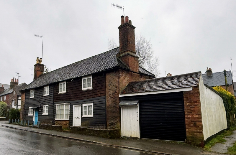
2. 2 C18 timber-framed cottages with brick infilling and partly tarred weather-boarded front. 2 storeys. 4 windows. Double hipped tiled roof with large brick stack at either end. 2 light casement windows. 3 sided bay window with glazing bars intact on ground floor of No 41. Wooden boarded doors with flat hoods over on brackets. Photograph in NMR.
Listing NGR: TQ1680449389
External links are from the relevant listing authority and, where applicable, Wikidata. Wikidata IDs may be related buildings as well as this specific building. If you want to add or update a link, you will need to do so by editing the Wikidata entry.


Other nearby listed buildings