Latitude: 50.7309 / 50°43'51"N
Longitude: -2.7566 / 2°45'23"W
OS Eastings: 346694
OS Northings: 92642
OS Grid: SY466926
Mapcode National: GBR PP.0KGK
Mapcode Global: FRA 5734.XHQ
Plus Code: 9C2VP6JV+98
Entry Name: 2, South Mill Lane
Listing Date: 19 September 1975
Grade: II
Source: Historic England
Source ID: 1227846
English Heritage Legacy ID: 402319
ID on this website: 101227846
Location: New Zealand, Dorset, DT6
County: Dorset
Civil Parish: Bridport
Built-Up Area: Bridport
Traditional County: Dorset
Lieutenancy Area (Ceremonial County): Dorset
Church of England Parish: Bridport St Mary
Church of England Diocese: Salisbury
Tagged with: Building
1.
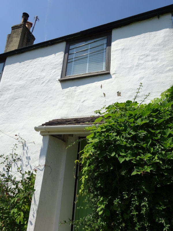
5191 SOUTH MILL LANE
No 2
SY 4692 1/417
II GV
2.
C19, possibly older. Rendered. Modern pitched roof. Tall rendered stack. 2 storeys.
2 ranges of modern casements. Modern door up 3 steps and in gabled porch.
Nos 2 to 16 (even) form a group with the walls of the Friend's Burial Ground, South Street.
Listing NGR: SY4669492643
External links are from the relevant listing authority and, where applicable, Wikidata. Wikidata IDs may be related buildings as well as this specific building. If you want to add or update a link, you will need to do so by editing the Wikidata entry.


Other nearby listed buildings