Approximate Location Map
Large Map »
Latitude: 50.7308 / 50°43'50"N
Longitude: -2.7567 / 2°45'24"W
OS Eastings: 346691
OS Northings: 92630
OS Grid: SY466926
Mapcode National: GBR PP.0KFH
Mapcode Global: FRA 5734.XHR
Plus Code: 9C2VP6JV+88
Entry Name: 6 and 8, South Mill Lane
Listing Date: 19 September 1975
Grade: II
Source: Historic England
Source ID: 1227847
English Heritage Legacy ID: 402321
ID on this website: 101227847
Location: New Zealand, Dorset, DT6
County: Dorset
Civil Parish: Bridport
Built-Up Area: Bridport
Traditional County: Dorset
Lieutenancy Area (Ceremonial County): Dorset
Church of England Parish: Bridport St Mary
Church of England Diocese: Salisbury
Tagged with: Building
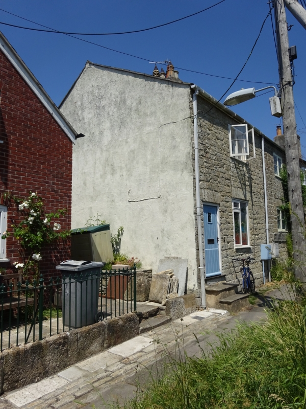
1.
5l91 SOUTH MILL LANE
Nos 6 & 8
SY 4692 1/419
II GV
2.
C19. Hammer dressed stone. No 8 roughcast. Pitched slate roof. Red brick stack.
2 storeys. 2 ranges of casements (ground floor of No 8's modern). No 6 has door
with 3 fielded panels. No 8 has modern door in deep-set porch.
Nos 2 to 16 (even) form a group with the walls of the Friends' Burial Ground. South Street.
Listing NGR: SY4668892628
External links are from the relevant listing authority and, where applicable, Wikidata. Wikidata IDs may be related buildings as well as this specific building. If you want to add or update a link, you will need to do so by editing the Wikidata entry.


Other nearby listed buildings
