Approximate Location Map
Large Map »
Latitude: 53.6451 / 53°38'42"N
Longitude: -1.7832 / 1°46'59"W
OS Eastings: 414428
OS Northings: 416536
OS Grid: SE144165
Mapcode National: GBR HVZ9.Q1
Mapcode Global: WHCB1.LM2X
Plus Code: 9C5WJ6W8+3P
Entry Name: 42-48, New Street
Listing Date: 29 September 1978
Grade: II
Source: Historic England
Source ID: 1228388
English Heritage Legacy ID: 402877
ID on this website: 101228388
Location: Huddersfield, Kirklees, West Yorkshire, HD1
County: Kirklees
Electoral Ward/Division: Newsome
Parish: Non Civil Parish
Built-Up Area: Huddersfield
Traditional County: Yorkshire
Lieutenancy Area (Ceremonial County): West Yorkshire
Church of England Parish: Huddersfield St Peter
Church of England Diocese: Leeds
Tagged with: Building
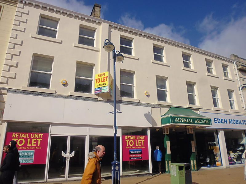
1.
5113
SE 1416 NW
1/946
NEW STREET
(West Side)
Nos 42 to 48 (even)
II
GV
2.
Early C19. Rendered. Pitched stone slate. 3 storeys. Stone brackets to
gutter. Rusticated quoins. 7 ranges of sashes. Modern shopfronts.
Listing NGR: SE1442816536
External links are from the relevant listing authority and, where applicable, Wikidata. Wikidata IDs may be related buildings as well as this specific building. If you want to add or update a link, you will need to do so by editing the Wikidata entry.


Other nearby listed buildings
