Approximate Location Map
Large Map »
Latitude: 53.6448 / 53°38'41"N
Longitude: -1.7833 / 1°46'59"W
OS Eastings: 414420
OS Northings: 416503
OS Grid: SE144165
Mapcode National: GBR HVZ9.Q5
Mapcode Global: WHCB1.LN04
Plus Code: 9C5WJ6V8+WM
Entry Name: 56, New Street
Listing Date: 29 September 1978
Grade: II
Source: Historic England
Source ID: 1287238
English Heritage Legacy ID: 402879
ID on this website: 101287238
Location: Huddersfield, Kirklees, West Yorkshire, HD1
County: Kirklees
Electoral Ward/Division: Newsome
Parish: Non Civil Parish
Built-Up Area: Huddersfield
Traditional County: Yorkshire
Lieutenancy Area (Ceremonial County): West Yorkshire
Church of England Parish: Huddersfield St Peter
Church of England Diocese: Leeds
Tagged with: Building
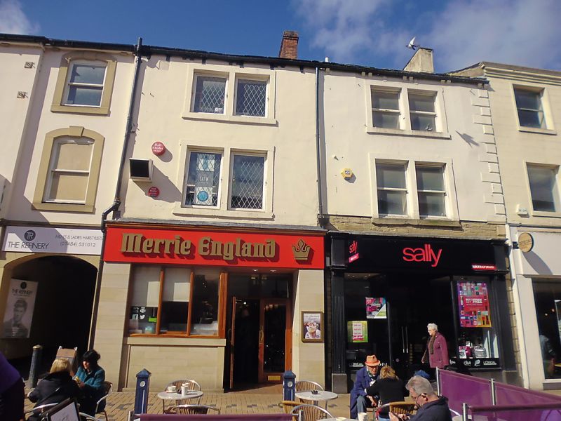
1.
5113
SE 1416 NW 1/950
SE 1416 SW 3/950
NEW STREET
(West Side)
No 56
II
GV
2.
Early C19. Hammer-dressed stone. Pitched stone slate roof. 3 storeys. Stone
brackets to gutter. One range of sashes over trabeated archway. One range
of bipartite stone mullioned sashes. Modern shop.
Listing NGR: SE1442016503
External links are from the relevant listing authority and, where applicable, Wikidata. Wikidata IDs may be related buildings as well as this specific building. If you want to add or update a link, you will need to do so by editing the Wikidata entry.


Other nearby listed buildings
