Approximate Location Map
Large Map »
Latitude: 50.7229 / 50°43'22"N
Longitude: -2.757 / 2°45'25"W
OS Eastings: 346662
OS Northings: 91750
OS Grid: SY466917
Mapcode National: GBR PP.0Z8V
Mapcode Global: FRA 5735.HRC
Plus Code: 9C2VP6FV+56
Entry Name: The Crown Inn
Listing Date: 30 October 1974
Grade: II
Source: Historic England
Source ID: 1229062
English Heritage Legacy ID: 403828
Also known as: Crown Inn
The Crown Inn, Bridport
ID on this website: 101229062
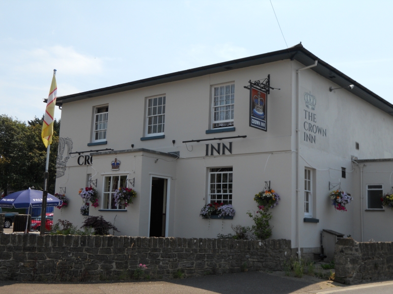
1.
5191 WEST BAY ROAD
(East Side)
The Crown Inn
SY 4691 9/505 30.10.74.
II GV
2.
Mid C19. Stucco. Hipped slate roof with overhanging eaves. 2 storeys.
Band. 3 ranges of sashes with glazing bars. Central porch.
No 61 and the Crown Inn form a group with Nos 74 and 74A on the west side.
Listing NGR: SY4666291750
External links are from the relevant listing authority and, where applicable, Wikidata. Wikidata IDs may be related buildings as well as this specific building. If you want to add or update a link, you will need to do so by editing the Wikidata entry.


Other nearby listed buildings
