Latitude: 52.9049 / 52°54'17"N
Longitude: -1.5064 / 1°30'22"W
OS Eastings: 433297
OS Northings: 334274
OS Grid: SK332342
Mapcode National: GBR PBN.X1
Mapcode Global: WHCFV.T7VW
Plus Code: 9C4WWF3V+XC
Entry Name: 19, Shepherd Street
Listing Date: 24 February 1977
Grade: II
Source: Historic England
Source ID: 1229476
English Heritage Legacy ID: 404298
ID on this website: 101229476
Location: Littleover, Derby, Derbyshire, DE23
County: City of Derby
Electoral Ward/Division: Littleover
Parish: Non Civil Parish
Built-Up Area: Derby
Traditional County: Derbyshire
Lieutenancy Area (Ceremonial County): Derbyshire
Church of England Parish: Littleover St Peter
Church of England Diocese: Derby
Tagged with: Building
SHEPHERD STREET 1. 5170 Littleover No 19 SK 33 SW 11/276 II GV
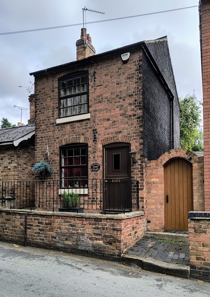
2. Early C19 small house. Red brick; 2 storeys; one sash window with segmental head and plain doorway with ledged door; plain eaves; slates. Included for group value.
Nos 11 and 15 to 19 (odd) form a group.
Listing NGR: SK3329734274
External links are from the relevant listing authority and, where applicable, Wikidata. Wikidata IDs may be related buildings as well as this specific building. If you want to add or update a link, you will need to do so by editing the Wikidata entry.


Other nearby listed buildings