Approximate Location Map
Large Map »
Latitude: 52.754 / 52°45'14"N
Longitude: -1.0866 / 1°5'11"W
OS Eastings: 461742
OS Northings: 317767
OS Grid: SK617177
Mapcode National: GBR 9MH.842
Mapcode Global: WHFK3.81TJ
Plus Code: 9C4WQW37+H8
Entry Name: 5, King Street
Listing Date: 7 December 1978
Grade: II
Source: Historic England
Source ID: 1230533
English Heritage Legacy ID: 405447
ID on this website: 101230533
Location: Seagrave, Charnwood, Leicestershire, LE12
County: Leicestershire
District: Charnwood
Civil Parish: Seagrave
Built-Up Area: Seagrave
Traditional County: Leicestershire
Lieutenancy Area (Ceremonial County): Leicestershire
Church of England Parish: Seagrave All Saints
Church of England Diocese: Leicester
Tagged with: Building
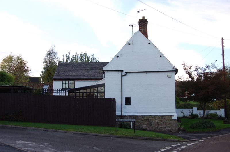
SEAGRAVE
SK 61 NW KING STREET (South Side)
4/139
7.12.78 No. 5
II
Cottage. C18. Whitewashed brick with granite rubble stone plinth and Swithland
slate roof with brick end stacks. 2 storeys of 2 2-light horizontal sliding
sashes, the ground floor left of 3-lights, right of 2-lights. Central 5-panelled
door.
Listing NGR: SK6174217767
External links are from the relevant listing authority and, where applicable, Wikidata. Wikidata IDs may be related buildings as well as this specific building. If you want to add or update a link, you will need to do so by editing the Wikidata entry.


Other nearby listed buildings
