Approximate Location Map
Large Map »
Latitude: 53.4331 / 53°25'59"N
Longitude: -2.6013 / 2°36'4"W
OS Eastings: 360147
OS Northings: 393094
OS Grid: SJ601930
Mapcode National: GBR BX8R.M1
Mapcode Global: WH98C.0YKZ
Plus Code: 9C5VC9MX+6F
Entry Name: Milestone
Listing Date: 19 July 1984
Grade: II
Source: Historic England
Source ID: 1230792
English Heritage Legacy ID: 405833
ID on this website: 101230792
Location: Winwick, Warrington, Cheshire, WA2
County: Warrington
Civil Parish: Winwick
Built-Up Area: Winwick
Traditional County: Lancashire
Lieutenancy Area (Ceremonial County): Cheshire
Church of England Parish: Winwick St Oswald
Church of England Diocese: Liverpool
Tagged with: Milestone
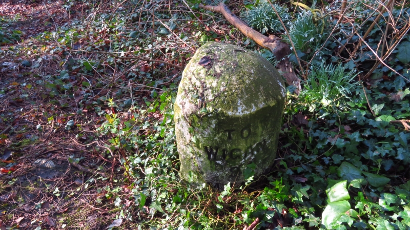
SJ 68 SW WINWICK C.P. NEWTON ROAD
601 931 (West Side)
2/20 Milestone
II
Milestone, mid C19 or earlier, of stone. Round front, straight back; the top is a
half-dome. Inscribed TO WIGAN 9 MILES TO WARRINGTON 3 MILES.
Listing NGR: SJ6014793094
External links are from the relevant listing authority and, where applicable, Wikidata. Wikidata IDs may be related buildings as well as this specific building. If you want to add or update a link, you will need to do so by editing the Wikidata entry.


Other nearby listed buildings
