Approximate Location Map
Large Map »
Latitude: 52.1972 / 52°11'49"N
Longitude: 1.4932 / 1°29'35"E
OS Eastings: 638818
OS Northings: 261188
OS Grid: TM388611
Mapcode National: GBR XQL.6B0
Mapcode Global: VHM7V.T1QH
Plus Code: 9F435FWV+V7
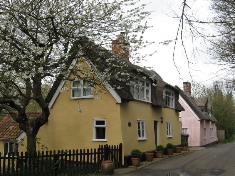
Entry Name: Sandy Cottage
Listing Date: 21 September 1983
Grade: II
Source: Historic England
Source ID: 1231328
English Heritage Legacy ID: 406258
ID on this website: 101231328
Location: Sternfield, East Suffolk, IP17
County: Suffolk
District: East Suffolk
Civil Parish: Sternfield
Traditional County: Suffolk
Lieutenancy Area (Ceremonial County): Suffolk
Church of England Parish: Sternfield St Mary Magdalene
Church of England Diocese: St.Edmundsbury and Ipswich
Tagged with: Cottage
TM 36 SE STERNFIELD SANDY LANE
Sandy Cottage
2/125
-
II
GV
House. Late C17. Timber framed and plastered, thatch. Single storey and
attic. 2 window range, mid C20 2-light casements; central doorway with boarded
door; 2 large mid C20 eyebrow dormers; internal stack. Brick and pantile lean-
to to rear.
Listing NGR: TM3881861188
External links are from the relevant listing authority and, where applicable, Wikidata. Wikidata IDs may be related buildings as well as this specific building. If you want to add or update a link, you will need to do so by editing the Wikidata entry.


Other nearby listed buildings
