Approximate Location Map
Large Map »
Latitude: 51.4626 / 51°27'45"N
Longitude: -2.4598 / 2°27'35"W
OS Eastings: 368153
OS Northings: 173836
OS Grid: ST681738
Mapcode National: GBR JX.M1Z3
Mapcode Global: VH88Q.9HYM
Plus Code: 9C3VFG7R+23
Entry Name: Mile Stone Immediately South East of Webb's Farmhouse
Listing Date: 15 July 1981
Grade: II
Source: Historic England
Source ID: 1231508
English Heritage Legacy ID: 406657
ID on this website: 101231508
Location: Bridge Yate, South Gloucestershire, BS30
County: South Gloucestershire
Civil Parish: Siston
Traditional County: Gloucestershire
Lieutenancy Area (Ceremonial County): Gloucestershire
Church of England Parish: Syston
Church of England Diocese: Bristol
Tagged with: Milestone
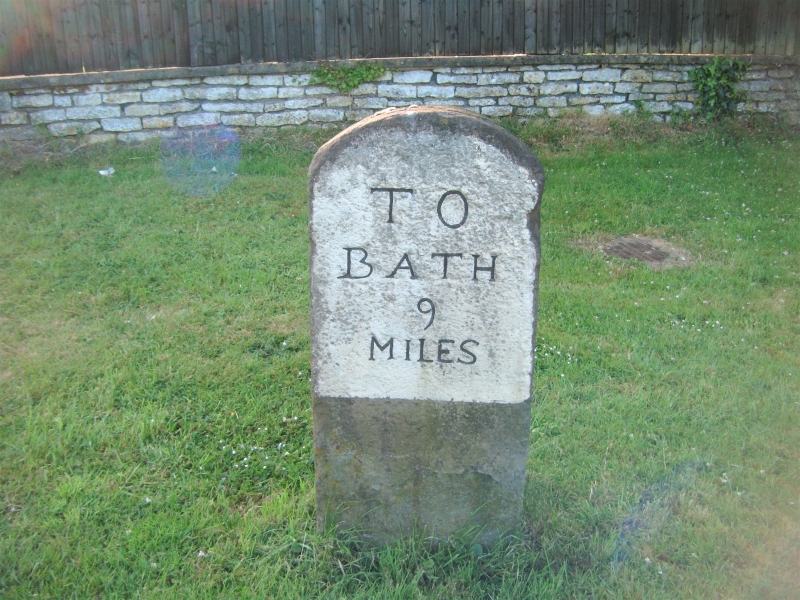
1.
5118 SISTON SISTON LANE
Mile stone immediately
south-east of Webb's Heath
ST 67 SE 4/224
II
2.
Circa 1800 probably. Round headed pennant stone, painted "To Bath 9 miles".
Listing NGR: ST6815373836
External links are from the relevant listing authority and, where applicable, Wikidata. Wikidata IDs may be related buildings as well as this specific building. If you want to add or update a link, you will need to do so by editing the Wikidata entry.


Other nearby listed buildings
