Approximate Location Map
Large Map »
Latitude: 54.7278 / 54°43'39"N
Longitude: -2.1735 / 2°10'24"W
OS Eastings: 388923
OS Northings: 536990
OS Grid: NY889369
Mapcode National: GBR FF8S.70
Mapcode Global: WHB3H.LF6G
Plus Code: 9C6VPRHG+4H
Entry Name: Middle Level Lead Mine North Bouse Teams
Listing Date: 5 June 1987
Grade: II
Source: Historic England
Source ID: 1231634
English Heritage Legacy ID: 406646
ID on this website: 101231634
Location: County Durham, DL13
County: County Durham
Civil Parish: Stanhope
Traditional County: Durham
Lieutenancy Area (Ceremonial County): County Durham
Church of England Parish: St John's Chapel
Church of England Diocese: Durham
Tagged with: Architectural structure
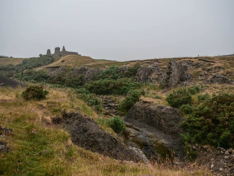
STANHOPE GREENLAWS
NY 83 NE
Daddry Shield
18/213 (inset)
Middle Level Lead
Mine north bouse
teams
GV
II
Lead mine bouse teams. 1860. Coursed squared sandstone. 6 enclosures, open
to south and built into hill, formed by stepped walls about 4 metres high.
Partly damaged at time of survey.
Listing NGR: NY8892336990
External links are from the relevant listing authority and, where applicable, Wikidata. Wikidata IDs may be related buildings as well as this specific building. If you want to add or update a link, you will need to do so by editing the Wikidata entry.


Other nearby listed buildings
