Latitude: 54.9973 / 54°59'50"N
Longitude: -1.4218 / 1°25'18"W
OS Eastings: 437084
OS Northings: 567120
OS Grid: NZ370671
Mapcode National: GBR LBHN.ZD
Mapcode Global: WHD4S.4N6C
Plus Code: 9C6WXHWH+W7
Entry Name: Boundary Wall to Numbers 1 to 22 (Consecutive) Fronting Road
Listing Date: 1 February 1983
Grade: II
Source: Historic England
Source ID: 1231875
English Heritage Legacy ID: 406738
ID on this website: 101231875
Location: South Shields, South Tyneside, Tyne and Wear, NE33
County: South Tyneside
Electoral Ward/Division: Beacon and Bents
Parish: Non Civil Parish
Built-Up Area: South Shields
Traditional County: Durham
Lieutenancy Area (Ceremonial County): Tyne and Wear
Church of England Parish: South Shields St Aidan and St Stephen (The Lawe)
Church of England Diocese: Durham
Tagged with: Wall
1. 5102 BROUGHTON ROAD (north side) Boundary wall to Nbs 1 to 22 (consec) fronting road NZ 3767 SW 6/15
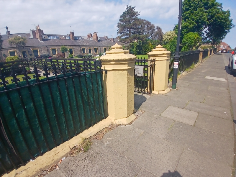
II GV 2. Circa 1850. Low stone wall with coping, with square stone piers spaced at regular intervals. The piers have pyramidal caps. Coarse modern brick panels between the piers replace the original cast iron railings.
Listing NGR: NZ3708467120
External links are from the relevant listing authority and, where applicable, Wikidata. Wikidata IDs may be related buildings as well as this specific building. If you want to add or update a link, you will need to do so by editing the Wikidata entry.


Other nearby listed buildings