Approximate Location Map
Large Map »
Latitude: 55.0011 / 55°0'3"N
Longitude: -1.4219 / 1°25'18"W
OS Eastings: 437078
OS Northings: 567540
OS Grid: NZ370675
Mapcode National: GBR LBHM.Y1
Mapcode Global: WHD4S.4K5G
Plus Code: 9C7W2H2H+C6
Entry Name: Canopy over Lifeboat
Listing Date: 1 February 1983
Grade: II
Source: Historic England
Source ID: 1277136
English Heritage Legacy ID: 407676
ID on this website: 101277136
Location: The Lawe, South Tyneside, Tyne and Wear, NE33
County: South Tyneside
Electoral Ward/Division: Beacon and Bents
Parish: Non Civil Parish
Built-Up Area: South Shields
Traditional County: Durham
Lieutenancy Area (Ceremonial County): Tyne and Wear
Church of England Parish: South Shields St Aidan and St Stephen (The Lawe)
Church of England Diocese: Durham
Tagged with: Architectural structure
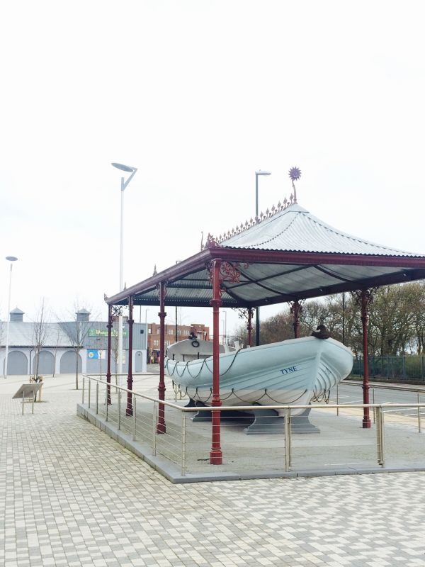
1.
5102 OCEAN ROAD
(east end)
Canopy over Lifeboat
NZ 36 NE 12/62
II GV
2.
Canopy protecting the lifeboat erected in 1894. Slender cast iron columns
supporting a hipped, tiled roof.
Elegant cast iron eaves brackets with honeysuckle motif.
Listing NGR: NZ3707867540
External links are from the relevant listing authority and, where applicable, Wikidata. Wikidata IDs may be related buildings as well as this specific building. If you want to add or update a link, you will need to do so by editing the Wikidata entry.


Other nearby listed buildings
