Latitude: 52.4472 / 52°26'49"N
Longitude: -2.2271 / 2°13'37"W
OS Eastings: 384660
OS Northings: 283273
OS Grid: SO846832
Mapcode National: GBR 1C1.FRZ
Mapcode Global: VH91G.BRZB
Plus Code: 9C4VCQWF+V5
Entry Name: 123 and 124, High Street
Listing Date: 18 December 1987
Grade: II
Source: Historic England
Source ID: 1231960
English Heritage Legacy ID: 407077
ID on this website: 101231960
Location: Dunsley, South Staffordshire, DY7
County: Staffordshire
District: South Staffordshire
Civil Parish: Kinver
Built-Up Area: Kinver
Traditional County: Staffordshire
Lieutenancy Area (Ceremonial County): Staffordshire
Church of England Parish: Kinver St Peter
Church of England Diocese: Lichfield
Tagged with: Building
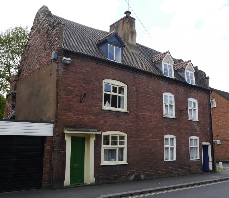
KINVER C.P. HIGH STREET (South-west side) SO 8483-8583 15/91 Nos 123 and 124 GV II Pair of houses. Early C18. Red brick; plain tile roof with Flemish gables; rendered central stack. 2 storeys and attic with dentilled eaves bands; 3 windows, C20 casements in C18 openings with segmental-headed door to the right (No. 123) giving access to an alleyway from which the house was entered; door to left with straight head and flat hood. Interior not inspected.
Listing NGR: SO8466083273
External links are from the relevant listing authority and, where applicable, Wikidata. Wikidata IDs may be related buildings as well as this specific building. If you want to add or update a link, you will need to do so by editing the Wikidata entry.


Other nearby listed buildings