Approximate Location Map
Large Map »
Latitude: 53.3268 / 53°19'36"N
Longitude: -2.0249 / 2°1'29"W
OS Eastings: 398435
OS Northings: 381100
OS Grid: SJ984811
Mapcode National: GBR GY9Z.D4
Mapcode Global: WHBBB.VMXY
Plus Code: 9C5V8XGG+P2
Entry Name: Standing Stone 170 Metres, North West of Cornfields Farm
Listing Date: 17 November 1983
Grade: II
Source: Historic England
Source ID: 1232106
English Heritage Legacy ID: 407427
ID on this website: 101232106
Location: Cheshire East, Cheshire, SK23
County: Cheshire East
Civil Parish: Lyme Handley
Traditional County: Cheshire
Lieutenancy Area (Ceremonial County): Cheshire
Church of England Parish: Disley St Mary
Church of England Diocese: Chester
SJ 98 SE
4/85
LYME HANDLEY C.P.
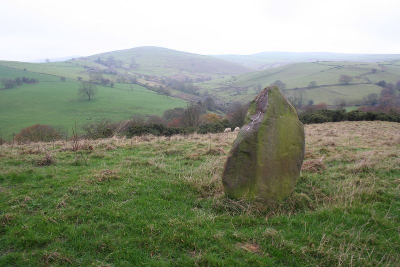
Standing stone 170m, north-west of Cornfields Farm.
II
Standing stone: Bronze Age. Sub-triangular sandstone block standing
c. 1.20m high on top of a long low hill and visible for some distance
on 3 sides of the compass.
Listing NGR: SJ 98435 81100
External links are from the relevant listing authority and, where applicable, Wikidata. Wikidata IDs may be related buildings as well as this specific building. If you want to add or update a link, you will need to do so by editing the Wikidata entry.


Other nearby listed buildings
