Approximate Location Map
Large Map »
Latitude: 55.006 / 55°0'21"N
Longitude: -1.4297 / 1°25'46"W
OS Eastings: 436576
OS Northings: 568084
OS Grid: NZ365680
Mapcode National: GBR LBGK.89
Mapcode Global: WHD4S.0FHP
Plus Code: 9C7W2H4C+94
Entry Name: East Beacon
Listing Date: 1 February 1983
Grade: II
Source: Historic England
Source ID: 1232155
English Heritage Legacy ID: 407492
ID on this website: 101232155
Location: The Lawe, South Tyneside, Tyne and Wear, NE33
County: South Tyneside
Electoral Ward/Division: Beacon and Bents
Parish: Non Civil Parish
Built-Up Area: South Shields
Traditional County: Durham
Lieutenancy Area (Ceremonial County): Tyne and Wear
Church of England Parish: South Shields St Aidan and St Stephen (The Lawe)
Church of England Diocese: Durham
Tagged with: Architectural structure
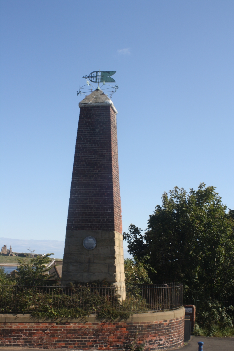
1.
5102 THE LAWE
East Beacon
NZ 3668 SE 3/39
II
2.
1832.
In the form of an obelisk, the lower third ashlar, the rest of brick with a
pyramidal stone cap. Surmounted by a weather vane.
Listing NGR: NZ3657668084
External links are from the relevant listing authority and, where applicable, Wikidata. Wikidata IDs may be related buildings as well as this specific building. If you want to add or update a link, you will need to do so by editing the Wikidata entry.


Other nearby listed buildings
