Latitude: 55.0078 / 55°0'27"N
Longitude: -1.4255 / 1°25'31"W
OS Eastings: 436843
OS Northings: 568285
OS Grid: NZ368682
Mapcode National: GBR LBHJ.5N
Mapcode Global: WHD4S.2DG9
Plus Code: 9C7W2H5F+4R
Entry Name: The South Groyne
Listing Date: 1 February 1983
Grade: II
Source: Historic England
Source ID: 1232321
English Heritage Legacy ID: 407679
Also known as: Herd Groyne Lighthouse
ID on this website: 101232321
Location: The Lawe, South Tyneside, Tyne and Wear, NE33
County: South Tyneside
Electoral Ward/Division: Beacon and Bents
Parish: Non Civil Parish
Built-Up Area: South Shields
Traditional County: Durham
Lieutenancy Area (Ceremonial County): Tyne and Wear
Church of England Parish: South Shields St Aidan and St Stephen (The Lawe)
Church of England Diocese: Durham
Tagged with: Lighthouse
1. 5102 SOUTH GROYNE The South Groyne NZ 3668 SE 3/65
II
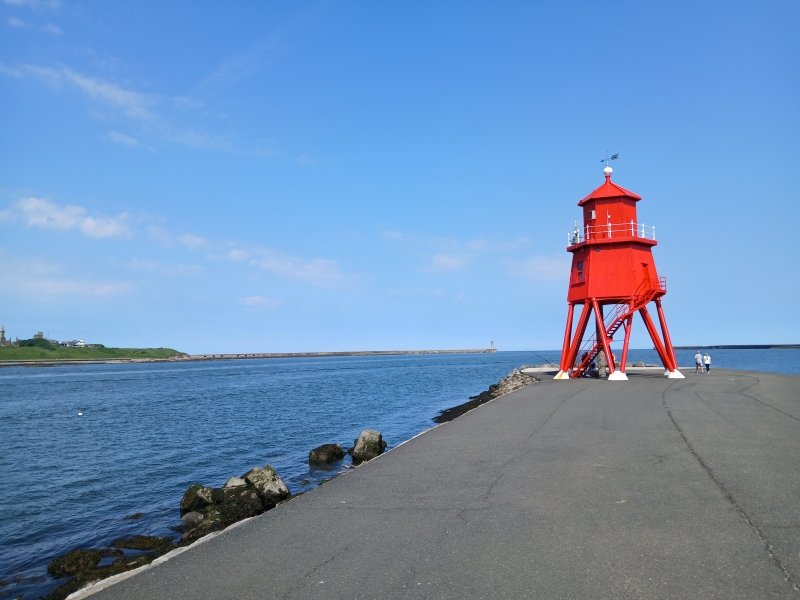
2. Built between 1861 and 1867, the dates of 2 plans made by the Tyne Improvement Commissioners circa 1882. Newcastle Trinity House erected on Iron Lighthouse. The original groyne is shown on the 1867 plan as a straight line. By 1883 the Commissioners were forming the southern wave trap at its western end thus giving it its present cranked shape. These works were carried out during the construction of the South Pier 1854-95. The outer faces of the groyne are of large roughly dressed stone, the upper surface now a mixture of concrete slabs, asphalt etc.
Listing NGR: NZ3684368285
External links are from the relevant listing authority and, where applicable, Wikidata. Wikidata IDs may be related buildings as well as this specific building. If you want to add or update a link, you will need to do so by editing the Wikidata entry.


Other nearby listed buildings