Latitude: 50.9851 / 50°59'6"N
Longitude: -1.5041 / 1°30'14"W
OS Eastings: 434905
OS Northings: 120746
OS Grid: SU349207
Mapcode National: GBR 75F.4KD
Mapcode Global: FRA 76QH.ZT2
Plus Code: 9C2WXFPW+29
Entry Name: Barn to North of Number 179
Listing Date: 4 December 1972
Grade: II
Source: Historic England
Source ID: 1232366
English Heritage Legacy ID: 407719
ID on this website: 101232366
Location: Romsey, Test Valley, Hampshire, SO51
County: Hampshire
District: Test Valley
Civil Parish: Romsey
Built-Up Area: Romsey
Traditional County: Hampshire
Lieutenancy Area (Ceremonial County): Hampshire
Church of England Parish: Romsey St Mary and St Ethelflaeda
Church of England Diocese: Winchester
Tagged with: Barn
MIDDLEBRIDGE STREET 1. (North-West Side) 1559 ------------------- Barn to north of No 179 SU 3420 2/214
II
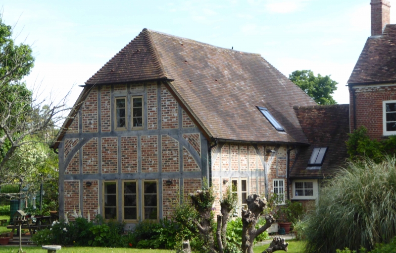
2. Barn now converted into a dwelling. Timber-framing visible in south-east side, facing Middlebridge; square panels of timber-framing and long diagonal braces. In south-west side, facing river, modern brick below, and weatherboarding above in gable end.
Listing NGR: SU3504920755
External links are from the relevant listing authority and, where applicable, Wikidata. Wikidata IDs may be related buildings as well as this specific building. If you want to add or update a link, you will need to do so by editing the Wikidata entry.


Other nearby listed buildings