Latitude: 50.9845 / 50°59'4"N
Longitude: -1.5042 / 1°30'15"W
OS Eastings: 434897
OS Northings: 120679
OS Grid: SU348206
Mapcode National: GBR 75F.BHD
Mapcode Global: FRA 76QH.ZS2
Plus Code: 9C2WXFMW+Q8
Entry Name: 1, Mainstone
Listing Date: 28 August 1951
Grade: II
Source: Historic England
Source ID: 1277228
English Heritage Legacy ID: 407422
ID on this website: 101277228
Location: Romsey, Test Valley, Hampshire, SO51
County: Hampshire
District: Test Valley
Civil Parish: Romsey Extra
Built-Up Area: Romsey
Traditional County: Hampshire
Lieutenancy Area (Ceremonial County): Hampshire
Church of England Parish: Romsey St Mary and St Ethelflaeda
Church of England Diocese: Winchester
Tagged with: Building
MAINSTONE 1. --------- 1559 No 1
SU 3420 2/113 28.8.51.
II GV
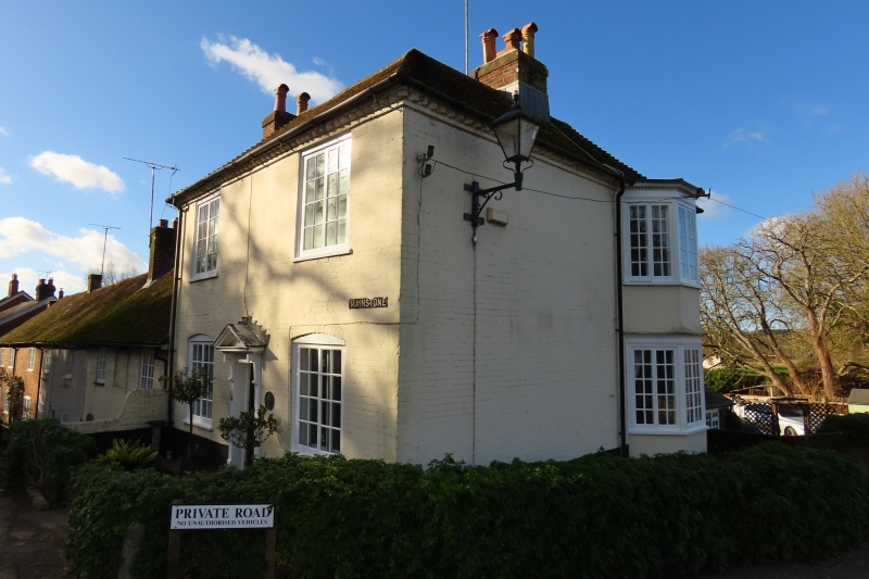
2. C18. 2-storeys. Colourwashed brick. Toothed brick eaves cornice. Old tile roof. Elevation to river has a 2-storey angular bay window to north-west with 2-light casements on each floor, and small dentilled cornice round head of bay, which is plastered below windows. Road elevation has 2, 2-light casement windows (segmental-headed) on ground floor. 6-panel door (flush type) with top 2 panels cut away and glazed. Door in architrave surround with doorcase of fluted pilasters, cross reeded brackets, fluted frieze, shallow moulded and dentilled cornice, broken forward over brackets and moulded and dentilled pediment. All casements original.
Middle Bridge, Nos 1 to 7 (odd) with Nos 177 & 179 Middlebridge Street form a group.
Listing NGR: SU3489720679
External links are from the relevant listing authority and, where applicable, Wikidata. Wikidata IDs may be related buildings as well as this specific building. If you want to add or update a link, you will need to do so by editing the Wikidata entry.


Other nearby listed buildings