Latitude: 52.5325 / 52°31'56"N
Longitude: -2.1848 / 2°11'5"W
OS Eastings: 387562
OS Northings: 292751
OS Grid: SO875927
Mapcode National: GBR 1B4.6GC
Mapcode Global: VH913.2LVY
Plus Code: 9C4VGRJ8+X3
Entry Name: Pauper's Cottage Wombrook Cottage
Listing Date: 13 August 1975
Grade: II
Source: Historic England
Source ID: 1232419
English Heritage Legacy ID: 407801
ID on this website: 101232419
Location: Blakeley, South Staffordshire, WV5
County: Staffordshire
District: South Staffordshire
Civil Parish: Wombourne
Built-Up Area: Wombourne
Traditional County: Staffordshire
Lieutenancy Area (Ceremonial County): Staffordshire
Church of England Parish: Wombourne St Benedict Biscop
Church of England Diocese: Lichfield
Tagged with: Cottage
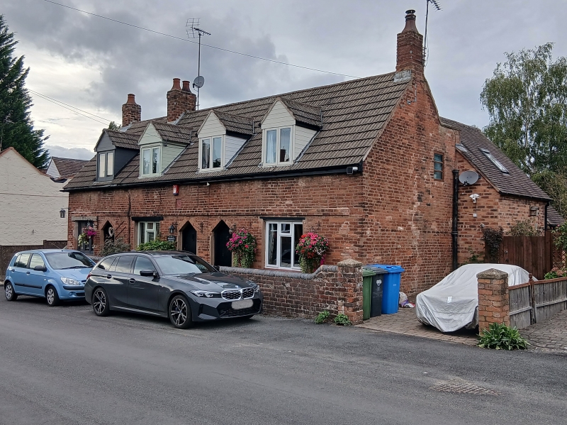
WOMBOURNE C.P. ROOKERY ROAD (north-west SO 89 SE side) 5/152 No. 117, No. 119 (Wom- brook cottage) & No. 121 13.8.75 Pauper's Cottage). GV II Terrace of 3 almshouses, now houses. Dated 1716 with C20 alterations. Red brick; interlocking concrete tile roof; brick integral end stacks and ridge stack. 3 single-cell cottages with extensions to the rear. One storey and attic with storey band; 3 bays, C20 casements to ground floor, 4 flat roofed attic dormers. 3 boarded doors with C19 triangular arches. Datestone in centre inscribed "The Poor/ye Have/allmayes/1716".
Listing NGR: SO8756292751
External links are from the relevant listing authority and, where applicable, Wikidata. Wikidata IDs may be related buildings as well as this specific building. If you want to add or update a link, you will need to do so by editing the Wikidata entry.


Other nearby listed buildings