Latitude: 50.9911 / 50°59'27"N
Longitude: -1.5033 / 1°30'11"W
OS Eastings: 434956
OS Northings: 121416
OS Grid: SU349214
Mapcode National: GBR 757.YHK
Mapcode Global: FRA 76RH.D4H
Plus Code: 9C2WXFRW+CM
Entry Name: 47, Mill Lane
Listing Date: 4 December 1972
Last Amended: 21 September 1988
Grade: II
Source: Historic England
Source ID: 1232713
English Heritage Legacy ID: 408116
ID on this website: 101232713
Location: Romsey, Test Valley, Hampshire, SO51
County: Hampshire
District: Test Valley
Civil Parish: Romsey
Built-Up Area: Romsey
Traditional County: Hampshire
Lieutenancy Area (Ceremonial County): Hampshire
Church of England Parish: Romsey St Mary and St Ethelflaeda
Church of England Diocese: Winchester
Tagged with: Building
The following building shall be added to the list
ROMSEY MILL LANE SU 3521
5/120 No 47
II
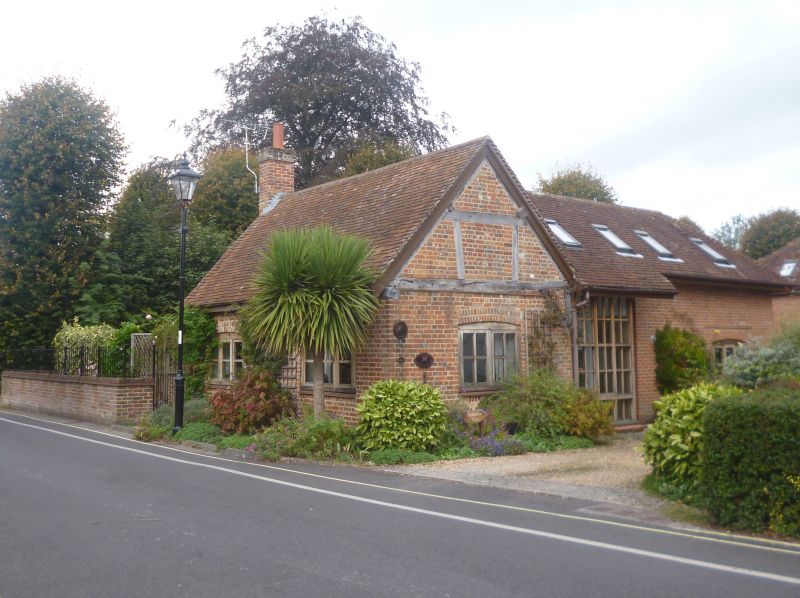
Cottage. Late C16, encased late C18, extensions early C20. Timber framed with brick encasing and plain tile roof. Along road; two bay single storey timber framed building with evidence for a central smoke bay, end stacks and later extensions at rear. Two 3-light casements on front elevation, porch on left side, timber framing exposed to gable ends. Inside, much timber framing survives including queen post roof, dovetailed tie beams and pegged rafters. In the C19 the building was used as a hopstore before returning to domestic use earlier this century.
Listing NGR: SU3611221569
External links are from the relevant listing authority and, where applicable, Wikidata. Wikidata IDs may be related buildings as well as this specific building. If you want to add or update a link, you will need to do so by editing the Wikidata entry.


Other nearby listed buildings