Latitude: 52.4226 / 52°25'21"N
Longitude: -1.2505 / 1°15'1"W
OS Eastings: 451068
OS Northings: 280772
OS Grid: SP510807
Mapcode National: GBR 8Q0.2PD
Mapcode Global: VHCTK.8CSQ
Plus Code: 9C4WCPFX+2R
Entry Name: The White House
Listing Date: 27 August 1986
Grade: II
Source: Historic England
Source ID: 1233437
English Heritage Legacy ID: 408939
ID on this website: 101233437
Location: Churchover, Rugby, Warwickshire, CV23
County: Warwickshire
District: Rugby
Civil Parish: Churchover
Traditional County: Warwickshire
Lieutenancy Area (Ceremonial County): Warwickshire
Church of England Parish: Churchover Holy Trinity
Church of England Diocese: Coventry
Tagged with: House
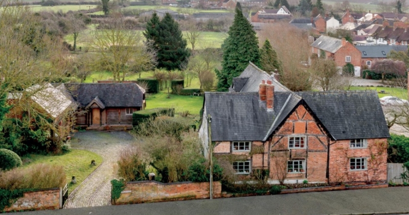
CHURCHOVER CHURCH STREET SP58SW (East side) 4/24 The White House GV II House. Late C17. Timber-framed, with later brick infill and cladding. Slate roof with brick stacks to ridge. 2 storeys; 3-window range. L-shaped plan. C20 glazed door within C19 brick lean-to to right. C19 six-pane window, and 3-light casement to first floor. C20 casement to right of ground floor, with C20 bay to left. Timber-framing exposed on front wall on gable end. Interior: open fireplace. Chamfered beams with stepped and ogee stops.
Listing NGR: SP5106880772
External links are from the relevant listing authority and, where applicable, Wikidata. Wikidata IDs may be related buildings as well as this specific building. If you want to add or update a link, you will need to do so by editing the Wikidata entry.


Other nearby listed buildings