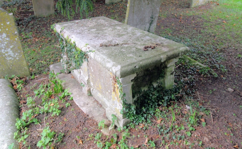
Latitude: 51.1166 / 51°6'59"N
Longitude: 0.9313 / 0°55'52"E
OS Eastings: 605255
OS Northings: 139343
OS Grid: TR052393
Mapcode National: GBR SYH.VPH
Mapcode Global: VHKKW.366C
Plus Code: 9F324W8J+JG
Entry Name: Tomb Chest to Elizabeth Mantel, About 20 Metres South of Church of St John
Listing Date: 16 February 1989
Grade: II
Source: Historic England
Source ID: 1233473
English Heritage Legacy ID: 408738
ID on this website: 101233473
Location: St John the Baptist's Church, The Forstal, Ashford, Kent, TN25
County: Kent
District: Ashford
Civil Parish: Mersham
Built-Up Area: Mersham
Traditional County: Kent
Lieutenancy Area (Ceremonial County): Kent
Tagged with: Tomb
TR 03 NE MERSHAM CHURCH ROAD (east side)
7/99 Tomb chest to Elizabeth Mantel, about 20 metres south of Church of St. John
GV II
Tomb chest. Elizabeth Mantel,d.1761. Simple chest with 3 moulded piers along long sides and to corners on base with moulded top slab. Simple inscription panels.
Listing NGR: TR0504039348
External links are from the relevant listing authority and, where applicable, Wikidata. Wikidata IDs may be related buildings as well as this specific building. If you want to add or update a link, you will need to do so by editing the Wikidata entry.


Other nearby listed buildings