Latitude: 51.1173 / 51°7'2"N
Longitude: 0.93 / 0°55'47"E
OS Eastings: 605158
OS Northings: 139415
OS Grid: TR051394
Mapcode National: GBR SYH.V8B
Mapcode Global: VHKKW.25HT
Plus Code: 9F324W8H+WX
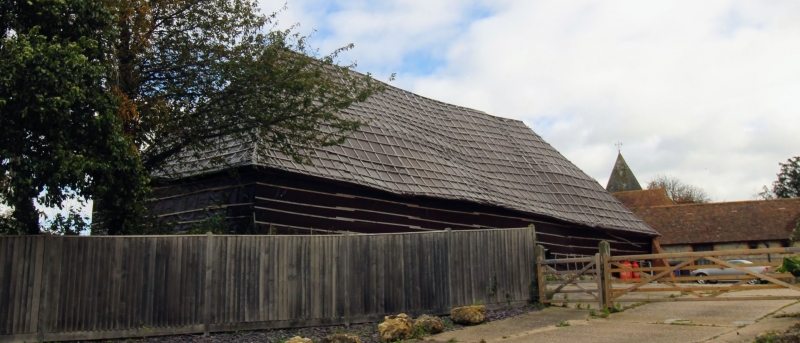
Entry Name: Barn About 30 Metres North West of Mersham Manor
Listing Date: 16 February 1989
Grade: II*
Source: Historic England
Source ID: 1233497
English Heritage Legacy ID: 408742
ID on this website: 101233497
Location: The Forstal, Ashford, Kent, TN25
County: Kent
District: Ashford
Civil Parish: Mersham
Built-Up Area: Mersham
Traditional County: Kent
Lieutenancy Area (Ceremonial County): Kent
Tagged with: Barn
TR 03 NE MERSHAM CHURCH ROAD (east side)
7/101 Barn about 30 metres north- west of Mersham Manor
GV II*
Barn. Early to mid C14. Timber framed and weatherboarded on ragstone base, with ragstone and red brick cladding to rear elevations. Plain tiled roof. Hipped roof with hipped streys to left and to right. Interior: 4 full bays with aisles with cantileveredterminal outshots, somewhat obscured by later divisions. One end bay and aisles extensively reconstructed c.1600, but main assembly and part of aisle (reversed assembly) probably contemporary with early C14 Mersham Manor adjacent. Keyed scarfs, with thick, nearly straight braces. Clasped purlin roof. (See S.E. Rigold. Major Kentish Barns, 21. One feature (pegged wedges) he dates elsewhere 1284-1306).
Listing NGR: TR0521239383
External links are from the relevant listing authority and, where applicable, Wikidata. Wikidata IDs may be related buildings as well as this specific building. If you want to add or update a link, you will need to do so by editing the Wikidata entry.


Other nearby listed buildings