Latitude: 50.8216 / 50°49'17"N
Longitude: -1.2466 / 1°14'47"W
OS Eastings: 453166
OS Northings: 102720
OS Grid: SU531027
Mapcode National: GBR 9BC.HMV
Mapcode Global: FRA 868X.Q52
Plus Code: 9C2WRQC3+J9
Entry Name: Meon Marsh Sealock and Bridge
Listing Date: 8 November 1990
Grade: II
Source: Historic England
Source ID: 1233937
English Heritage Legacy ID: 409532
ID on this website: 101233937
Location: Meon, Fareham, Hampshire, PO14
County: Hampshire
District: Fareham
Electoral Ward/Division: Titchfield
Parish: Non Civil Parish
Traditional County: Hampshire
Lieutenancy Area (Ceremonial County): Hampshire
Church of England Parish: Titchfield St Peter
Church of England Diocese: Portsmouth
Tagged with: Bridge
SU 50 SW TITCHFIELD POSBROOK LANE 23/525 Meon Marsh Sealock and Bridge. II
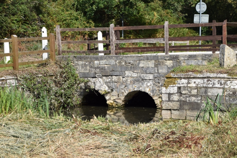
Former sea lock and bridge. Lock probably C1611 for Henry, second Earl of Southampton; bridge C18; later alterations. Stone, on south west side, lock has retaining walls of coursed squared stone with cyma-moulded coping stones which return a short distance to north-west and south-east, at north-east ends the walls each have a recess (probably from original gate/sluice mechanism). The space between the walls is filled by the inserted C18 bridge which is of crudely-cut stone and has 3 small round arches with roussoirs. A stone pier at north-west side has mason's marks. On the north-east side the retaining walls are of large rubblestones, the north-west side with some coping before, and the space between the walls is filled with sandbags (not of special interest). The lock is believed to have been completed in 1611 as part of the Earl of Southampton's scheme to close the Meon estuary and replace the navigable tidal channel by a canal, which would also drain and irrigate the meadows. It is, therefore, a surviving structure from one of England's earliest canal navigation systems. The canal became redundant within 100 years of its construction and the bridge was inserted subsequently. Archaeological excavation at the southern corner on the north-east side revealed masonry and plan form as on the south-west side, with a mortice for a 2nd sluice gate. It appears that boats collected on either side of the lock awaiting tidal changes and the necessary rise or fall in water levels to enable access to and from the sea.
Listing NGR: SU5799407358
External links are from the relevant listing authority and, where applicable, Wikidata. Wikidata IDs may be related buildings as well as this specific building. If you want to add or update a link, you will need to do so by editing the Wikidata entry.


Other nearby listed buildings