Latitude: 51.4888 / 51°29'19"N
Longitude: -2.6719 / 2°40'18"W
OS Eastings: 353445
OS Northings: 176866
OS Grid: ST534768
Mapcode National: GBR JM.KGLX
Mapcode Global: VH88D.MVV1
Plus Code: 9C3VF8QH+G6
Entry Name: 21, Park Hill
Listing Date: 15 December 1972
Grade: II
Source: Historic England
Source ID: 1234714
English Heritage Legacy ID: 380086
ID on this website: 101234714
Location: Shirehampton, Bristol, BS11
County: City of Bristol
Electoral Ward/Division: Avonmouth and Lawrence Weston
Parish: Non Civil Parish
Built-Up Area: Bristol
Traditional County: Gloucestershire
Lieutenancy Area (Ceremonial County): Bristol
Church of England Parish: Shirehampton
Church of England Diocese: Bristol
Tagged with: Building
BRISTOL
ST5376NW PARK HILL, Shirehampton 901-1/18/1757 (South side) 15/12/72 No.21
II
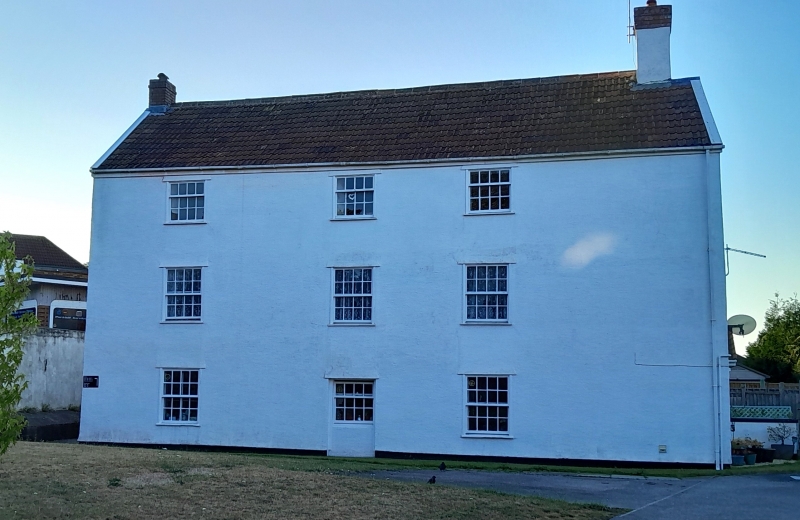
Formerly known as: No.19 PARK HILL. House. Late C18, converted to flats c1980. Rendered with brick gable end stacks and a pantile roof. Double-depth plan. 3 storeys; 3-window range. Parapeted front with the fenestration in a group of 6 windows to the right, and extended by a single-window range to the left, with the central door replaced by a window; 8/8-pane sashes, 4/8 on the second floor. INTERIOR not inspected.
Listing NGR: ST5344576866
External links are from the relevant listing authority and, where applicable, Wikidata. Wikidata IDs may be related buildings as well as this specific building. If you want to add or update a link, you will need to do so by editing the Wikidata entry.


Other nearby listed buildings