Approximate Location Map
Large Map »
Latitude: 55.575 / 55°34'30"N
Longitude: -1.6703 / 1°40'13"W
OS Eastings: 420887
OS Northings: 631314
OS Grid: NU208313
Mapcode National: GBR J3SZ.5B
Mapcode Global: WHC0T.94WF
Plus Code: 9C7WH8GH+2V
Entry Name: Pant and Trough at West End of Village
Listing Date: 22 December 1969
Grade: II
Source: Historic England
Source ID: 1234763
English Heritage Legacy ID: 410379
ID on this website: 101234763
Location: North Sunderland, Northumberland, NE68
County: Northumberland
Civil Parish: North Sunderland
Built-Up Area: Seahouses
Traditional County: Northumberland
Lieutenancy Area (Ceremonial County): Northumberland
Church of England Parish: North Sunderland St Paul
Church of England Diocese: Newcastle
Tagged with: Manger
NORTH SUNDERLAND MAIN STREET
NU 23 SW
(west end)
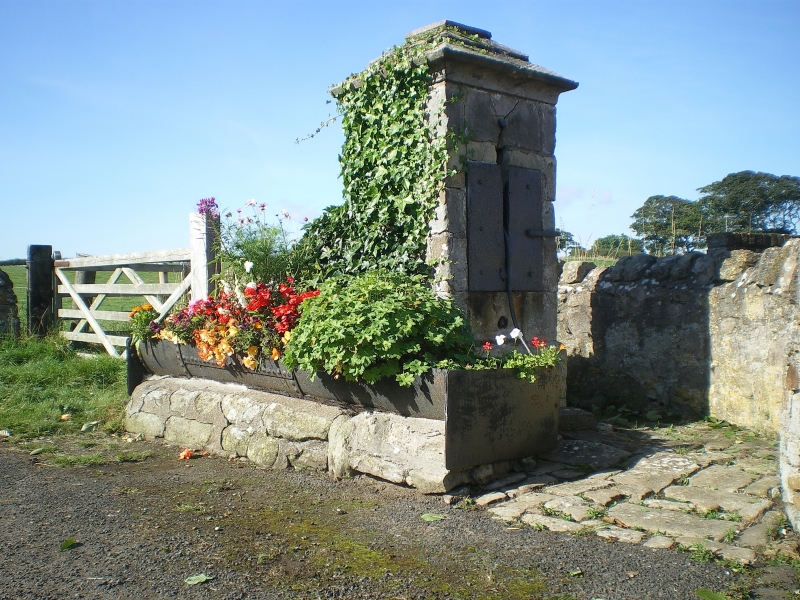
9/182 Pant and trough
at west end
22.12.69 of village
II
Well or pant. Early C19. Ashlar and iron. Large square pier with cornice
and pyramidal cap. Iron spout and large iron trough in front.
Listing NGR: NU2088731314
External links are from the relevant listing authority and, where applicable, Wikidata. Wikidata IDs may be related buildings as well as this specific building. If you want to add or update a link, you will need to do so by editing the Wikidata entry.


Other nearby listed buildings
