Approximate Location Map
Large Map »
Latitude: 50.983 / 50°58'58"N
Longitude: 0.7344 / 0°44'3"E
OS Eastings: 592025
OS Northings: 123960
OS Grid: TQ920239
Mapcode National: GBR RYN.6HX
Mapcode Global: FRA D6FJ.1XR
Plus Code: 9F22XPMM+6P
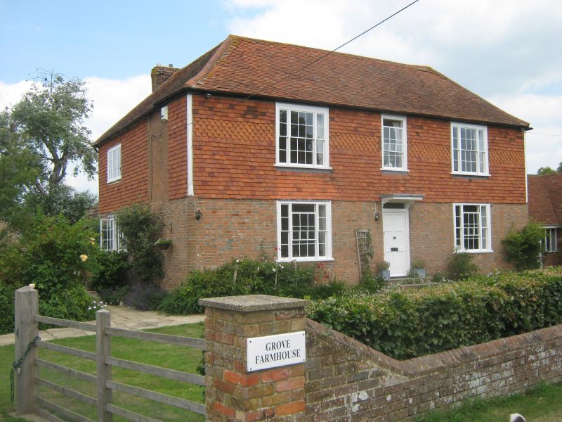
Entry Name: Grove Farmhouse
Listing Date: 13 May 1987
Grade: II
Source: Historic England
Source ID: 1234858
English Heritage Legacy ID: 410789
ID on this website: 101234858
Location: Iden, Rother, East Sussex, TN31
County: East Sussex
District: Rother
Civil Parish: Iden
Built-Up Area: Iden
Traditional County: Sussex
Lieutenancy Area (Ceremonial County): East Sussex
Church of England Parish: Iden All Saints
Church of England Diocese: Chichester
Tagged with: Farmhouse
TQ 92 SW IDEN GROVE LANE
16/17 Grove Farmhouse
II
C18. Two storeys. Three windows. Ground floor red brick, above tile-hung.
Tiled roof. Glazing bars intact. Doorway with flat hood on brackets.
Listing NGR: TQ9202523960
External links are from the relevant listing authority and, where applicable, Wikidata. Wikidata IDs may be related buildings as well as this specific building. If you want to add or update a link, you will need to do so by editing the Wikidata entry.


Other nearby listed buildings
