Latitude: 51.5751 / 51°34'30"N
Longitude: -0.7765 / 0°46'35"W
OS Eastings: 484884
OS Northings: 186953
OS Grid: SU848869
Mapcode National: GBR D5W.8HD
Mapcode Global: VHDWB.HNCX
Plus Code: 9C3XH6GF+2C
Entry Name: 21 and 23, Trinity Road
Listing Date: 31 January 1974
Grade: II
Source: Historic England
Source ID: 1234978
English Heritage Legacy ID: 411076
ID on this website: 101234978
Location: Marlow, Buckinghamshire, SL7
County: Buckinghamshire
Civil Parish: Marlow
Built-Up Area: Marlow
Traditional County: Buckinghamshire
Lieutenancy Area (Ceremonial County): Buckinghamshire
Church of England Parish: Great Marlow with Marlow Bottom, Little Marlow and Bisham
Church of England Diocese: Oxford
Tagged with: Building
1. TRINITY ROAD l385 Nos 21 and 23 21 and +3 SU 8486 1/134 II
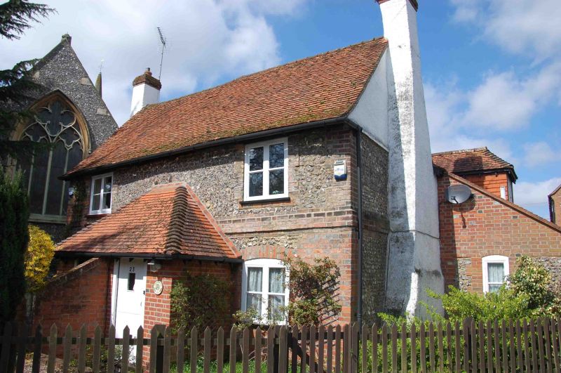
2. C18 semi-detached pair. 2 storeys, 2 windows, flint and brick. Rounded ground floor window Casements. Common central tiled and carved porch with 2 adjacent central doors. 2 gables to back in brick, old tile roof.
Listing NGR: SU8488486953
External links are from the relevant listing authority and, where applicable, Wikidata. Wikidata IDs may be related buildings as well as this specific building. If you want to add or update a link, you will need to do so by editing the Wikidata entry.


Other nearby listed buildings