Latitude: 51.4952 / 51°29'42"N
Longitude: -0.1364 / 0°8'10"W
OS Eastings: 529467
OS Northings: 179011
OS Grid: TQ294790
Mapcode National: GBR FL.K5
Mapcode Global: VHGQZ.LP84
Plus Code: 9C3XFVW7+3C
Entry Name: United Westminster Almshouses
Listing Date: 15 May 1974
Grade: II
Source: Historic England
Source ID: 1235246
English Heritage Legacy ID: 425879
Also known as: Westminster Almshouses Foundation
ID on this website: 101235246
Location: Victoria, Westminster, London, SW1P
County: London
District: City of Westminster
Electoral Ward/Division: Vincent Square
Parish: Non Civil Parish
Built-Up Area: City of Westminster
Traditional County: Middlesex
Lieutenancy Area (Ceremonial County): Greater London
Church of England Parish: St Stephen Rochester Row
Church of England Diocese: London
Tagged with: Architectural structure
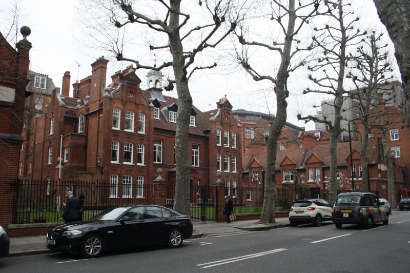
TQ 2979 CITY OF WESTMINSTER ROCHESTER ROW SW1 99/31 United Westminster 15.5.74 Almshouses - II Almshouses. 1880-2. R R Arnteg architect. Built to replace three former blocks of almshouses. Two storeys and attic centre, three storey flanking slightly projecting wings finished with Flemish gables. Centre three windows wood mullion and transom and projecting solid porch with Doric corner piers and tryglyph frieze and pediment in rubbed brick keystones. Sill band, covered eaves cornice, tile roof with three pedimented dormers and square cupola with dome and window arch. The projecting wings have three windows per floor with keystones, round windows in gable. The windows in the wings are sashes with glazing bars to their upper halves only.
Listing NGR: TQ2946779011
External links are from the relevant listing authority and, where applicable, Wikidata. Wikidata IDs may be related buildings as well as this specific building. If you want to add or update a link, you will need to do so by editing the Wikidata entry.


Other nearby listed buildings