Latitude: 51.4903 / 51°29'24"N
Longitude: -0.1517 / 0°9'6"W
OS Eastings: 528419
OS Northings: 178431
OS Grid: TQ284784
Mapcode National: GBR BM.3Y
Mapcode Global: VHGQZ.BS5Y
Plus Code: 9C3XFRRX+48
Entry Name: St Barnabas Parsonage and Gateway to North
Listing Date: 5 February 1970
Grade: II
Source: Historic England
Source ID: 1235526
English Heritage Legacy ID: 426264
ID on this website: 101235526
Location: Belgravia, Westminster, London, SW1W
County: London
District: City of Westminster
Electoral Ward/Division: Churchill
Parish: Non Civil Parish
Built-Up Area: City of Westminster
Traditional County: Middlesex
Lieutenancy Area (Ceremonial County): Greater London
Church of England Parish: St Barnabas Pimlico
Church of England Diocese: London
Tagged with: Architectural structure
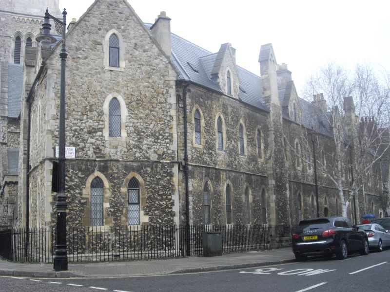
TQ 2878 SW CITY OF WESTMINSTER ST BARNABAS STREET, SW1 107/10 (east side) 5.2.70 St Barnabas Parsonage and gateway to north GV II Parsonage. Circa 1850. Cundy Junior. Ragstone, ashlar dressings, pitched slate roof to eaves. Early English Gothic style. Corner site. 2 storeys and dormers. 3 windows to St Barnabas Street, 14 windows to Ranelagh Grove. Main entrance to St Barnabas Street in courtyard reached through archway, and flanked by 2 polygonal turrets with conical ashlar roofs. Chimney stacks rising on outer walls at intervals with gabled cresting; painted lancet windows between; leaded diamond panes; gabled dormers to Ranelagh Grove facade. Forms part of unified composition with St Barnabas Church and school London, Vol I, N Pevsner:
Listing NGR: TQ2841978431
External links are from the relevant listing authority and, where applicable, Wikidata. Wikidata IDs may be related buildings as well as this specific building. If you want to add or update a link, you will need to do so by editing the Wikidata entry.


Other nearby listed buildings