Latitude: 51.5578 / 51°33'28"N
Longitude: -0.0827 / 0°4'57"W
OS Eastings: 533009
OS Northings: 186068
OS Grid: TQ330860
Mapcode National: GBR HC.FV1
Mapcode Global: VHGQT.J34L
Plus Code: 9C3XHW58+4W
Entry Name: 147 and 149, Albion Road N16
Listing Date: 23 July 1987
Grade: II
Source: Historic England
Source ID: 1235678
English Heritage Legacy ID: 426482
ID on this website: 101235678
Location: Stoke Newington, Hackney, London, N16
County: London
District: Hackney
Electoral Ward/Division: Clissold
Parish: Non Civil Parish
Built-Up Area: Hackney
Traditional County: Middlesex
Lieutenancy Area (Ceremonial County): Greater London
Church of England Parish: St Mary Stoke Newington
Church of England Diocese: London
Tagged with: Building
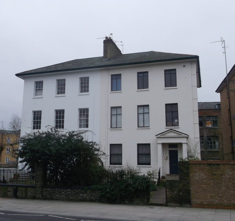
ALBION ROAD N16
1.
5013
Nos 147 and 149
TQ 3386 12/3003
II GV
2.
Pair of houses. Circa 1840. Stuccoed. Slated low pitched, hipped roof to eaves.
3 bays. 3 storeys plus basement. Entrances to outer bays, with projecting porches
having square piers and pediments. 4-panelled door to No 147; altered door to No 149.
Square headed windows sashed with glazing bars to No 147; mainly replacement casement
glazing to No 149. Central chimney stack.
Listing NGR: TQ3300986068
External links are from the relevant listing authority and, where applicable, Wikidata. Wikidata IDs may be related buildings as well as this specific building. If you want to add or update a link, you will need to do so by editing the Wikidata entry.


Other nearby listed buildings