Approximate Location Map
Large Map »
Latitude: 51.2901 / 51°17'24"N
Longitude: 0.379 / 0°22'44"E
OS Eastings: 565982
OS Northings: 157244
OS Grid: TQ659572
Mapcode National: GBR NPJ.0N1
Mapcode Global: VHJM4.JT7V
Plus Code: 9F3279RH+3J
Entry Name: Morphews Oast
Listing Date: 20 December 1973
Grade: II
Source: Historic England
Source ID: 1236094
English Heritage Legacy ID: 427017
ID on this website: 101236094
Location: Tower Hill, Tonbridge and Malling, Kent, ME19
County: Kent
District: Tonbridge and Malling
Civil Parish: Offham
Built-Up Area: Offham
Traditional County: Kent
Lieutenancy Area (Ceremonial County): Kent
Church of England Parish: Offham St Michael
Church of England Diocese: Rochester
Tagged with: Architectural structure
TQ6457-6557 OFFHAM C.P. TESTON ROAD
8/18 (south side)
20.12.73
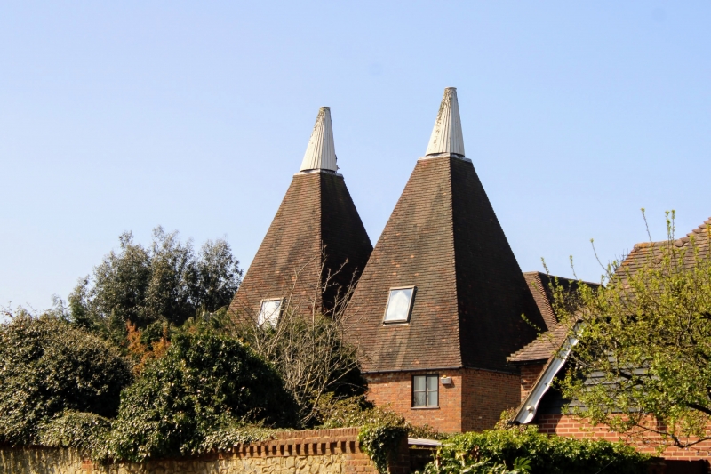
Morphews Oast
II
Two square oasts and granary. Mid C19. Oasts of rubble stone below with tall
square slate roofs. Cowls and wind-vanes. Large 2-storey red brick granary with
plain tiled roof in three ridges. Various ground and 1st floor openings. At time
of re-survey in process of conversion into dwelling accommodation.
Listing NGR: TQ6598257244
External links are from the relevant listing authority and, where applicable, Wikidata. Wikidata IDs may be related buildings as well as this specific building. If you want to add or update a link, you will need to do so by editing the Wikidata entry.


Other nearby listed buildings
